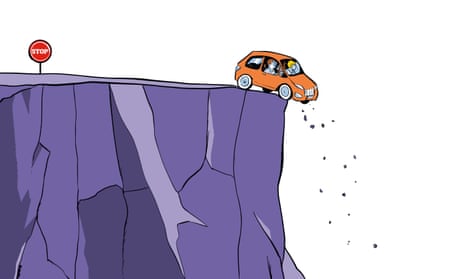
One early morning in March 2011, Albert Chretien and his wife, Rita, loaded their Chevrolet Astro van and drove away from their home in Penticton, British Columbia. Their destination was Las Vegas, where Albert planned to attend a trade show. Rather than stick to the most direct route, they decided to take a scenic road less travelled, Idaho State Highway 51. The Chretiens figured there had to be a turnoff from Idaho 51 that would lead them east to US Route 93 all the way to Vegas.
Albert and Rita had known each other since high school. During their 38 years of marriage, they had rarely been apart. They worked together, managing their own small excavation business. A few days before the trip, Albert had purchased a Magellan GPS unit for the van. They had not yet used it, but their plan wasn’t panning out. As the day went on and the shadows grew longer, they hadn’t found an eastward passage. They decided to consult the GPS. Checking their roadmap, they determined the nearest town was Mountain City, Nevada, so they entered it as the destination into their GPS unit. The directions led them on to a small dirt road near an Idaho ghost town and eventually to a confusing three-way crossroads. And here their troubles began.
If Albert had been navigating the route in the daytime, he might have noticed that it was taking them through the high desert as it rose toward shimmering snowy peaks in the distance. In the dark, the changes were so subtle that they barely registered. And besides, he was on a road – “a pretty good road”, the Elko county sheriff would later say, that “slowly goes bad”. Through the night, it carried them higher into the Jarbidge mountains, deeper into the back country. The road twisted, dipped, rose again, skirting canyons walled with sagebrush.
Several days passed before their family and friends realised that Albert and Rita had never arrived at the trade show. The couple had not informed anyone of their detour, so nobody knew where to look for them. The manhunt involved police agencies in four states, scouring 3,000 miles of highway, with the most intense efforts in eastern Oregon, where they had used a credit card in a convenience store.
On 8 April, just shy of three weeks since Albert Chretien left Highway 51, authorities announced they were scaling back search and rescue efforts, a tacit admission that wherever the Chretiens had gone, it was too late to find them.
What happened to the Chretiens is so common in some places that it has a name. The rangers at Death Valley national park in California call it “death by GPS”. It describes what happens when your GPS fails you, not by being wrong, exactly, but often by being too right. It does such a good job of computing the most direct route from point A to point B that it takes you down roads that barely exist, or were used at one time and abandoned, or are not suitable for your car, or that require local knowledge that would make you aware that making that turn is bad news.
Death Valley’s vast arid landscape and temperature extremes make it a particularly dangerous place to rely on GPS. In the summer of 2009, Alicia Sanchez, a 28-year-old nurse, was driving through the park with her six-year-old son, Carlos, when her GPS directed her on to a vaguely defined road that she followed for 20 miles, unaware that it had no outlet. A week later, a ranger discovered Sanchez’s Jeep, buried in sand up to its axles, with SOS spelled out in medical tape on the windshield. “She came running toward me and collapsed in my arms,” the ranger wrote in a report. Her son had died. “I walked over to the Jeep and looked inside. I saw a boy slumped in the front seat.”
Most death by GPS incidents do not involve actual deaths – or even serious injury. They are accidents or accidental journeys brought about by an uncritical acceptance of turn-by-turn commands: the Japanese tourists in Australia who drove their car into the ocean while attempting to reach North Stradbroke Island from the mainland; the man who drove his BMW down a narrow, steep path in a village in Yorkshire and nearly over a cliff; the woman in Bellevue, Washington, who drove her car into a lake that the GPS said was a road; the Swedish couple who asked GPS to guide them to the Mediterranean island of Capri, but instead arrived at the northern Italian industrial town of Carpi; the elderly woman in Belgium who tried to use GPS to guide her to Brussels, 90 miles from her home, but drove hundreds of miles to Zagreb, only realising her mistake when she noticed the street signs were in Croatian.
These types of mishaps often elicit sheer bafflement. The local Italian tourist official noted that although “Capri is an island”, the unfortunate Swedes “did not even wonder why they didn’t cross any bridge or take any boat”; the first responders in Bellevue were amazed that the woman “wouldn’t question driving into a puddle that doesn’t seem to end”. For their part, the victims often couch their experiences in language that attributes to GPS a peculiar sort of agency. GPS “told us we could drive down there”, one of the Japanese tourists explained. “It kept saying it would navigate us to a road.” The BMW driver echoed these words, almost verbatim: “It kept insisting the path was a road.”

Anyone who has driven a car through an unfamiliar place can attest to how easy it is to let GPS do all the work. That GPS can have a transformative effect on a society is undeniable. We have come to depend on a technology that, in theory, makes it impossible to get lost. But not only are we still getting lost, we may actually be losing a part of ourselves.
In 1948, nearing the end of his career, Edward Tolman, a Berkeley psychology professor, published an article called Cognitive Maps In Rats And Men in the journal Psychological Review. He summarised several experiments that studied the wayfinding behaviour of rats wandering mazes in search of a reward. Tolman argued that they had much to teach us about how humans navigate and orient themselves.
He believed that the rats had a “cognitive map”, a mental representation of their environment, that could be divided into two basic models: strip maps and comprehensive maps. A strip map is a basic understanding of two points: an unbroken line from A to B. If one knows an environment intimately, and can add in more details, this can turn into a comprehensive map.
Beginning in the early 1970s, Tolman’s cognitive map concept, or how we perceive locations in our mind’s eye, experienced a renaissance when it was adopted by psychologists, geographers, architects and anyone interested in wayfinding. Interpretations of the term vary, but most see the cognitive map as “a map-like representation within the ‘black box’ of the nervous system”, says geographer Rob Kitchin.
Which brings us to GPS, a technology Tolman never lived to see. What might Tolman have thought of our devotion to GPS as a means of making our way through this maze? The soothing voice of the turn-by-turn directions, guiding us through an unfamiliar environment, is the personification of the strip map. Allegiance to that strip map promotes the reasoning that lies behind the most baffling death-by-GPS scenarios, the willingness to “turn right here” when “here” is clearly a lake.
But the spectre of the strip map also haunts the scarier incidents, like the disappearance of the Chretiens – scary because we can imagine them happening to us. Who can fault Albert Chretien for following a road, even if he lacked a map comprehensive enough to know it was a road best not taken? Let those who have never experienced the liberating sensation of switching on GPS and switching off their navigational awareness cast the first stone.
The rise of personal GPS devices (including its integration into mobile phones) has been so meteoric that we are just beginning to take stock of how the technology can affect us. Are we witnessing the mass narrowing of the human cognitive map? If we are, we are doing it to ourselves, our love of GPS creating the conditions that lead to that narrowing.
A British study, published in 2006, made headlines by revealing that the brains of London taxi drivers, whose licensing requires that they demonstrate recall of 25,000 city streets, plus the locations of landmarks and points of interest, contain more grey matter in the region of the hippocampus responsible for complex spatial representation than the brains of London bus drivers. Brain scan results from retired taxi drivers suggested, without being conclusive, that the volume of grey matter decreases when this ability is no longer required.
The idea that something similar may be happening on a large scale, as GPS use becomes more ubiquitous, is plausible enough to be taken seriously. More recent research has demonstrated that someone who does intensive exercises to improve navigational skills can exhibit changes in the hippocampus. Hugo Spiers, one of the scientists who conducted the London cab driver study, explains: “I think it’s possible that if you went to someone doing a lot of active navigation, but just relying on GPS – the assumption being that they’d be minimising the brain’s use for navigation – you’d actually get a reduction in that area.”
In a study conducted in Japan and published in 2008, three groups of walkers navigated routes in the city of Kashiwa. One group learned the route from direct experience; another group was given GPS devices; a third group was given a paper map with the beginning and end points marked, but no highlighted route. The results showed the GPS users exhibiting the weakest wayfinding acumen. They travelled at a slower speed and made more stops to reorient themselves than the walkers in the other groups. They rated the overall task as more difficult, and in post-walk tests, had the lowest scores on memory of the configuration and topology of the route.
A Cornell University study published in the same year looked at GPS’s effect on drivers, and reached similar conclusions. Their research “found evidence for loss of environmental engagement”. Their conclusion: “GPS eliminated much of the need to pay attention.”
So what happens to our brains as we transition into a world where GPS does it all for us? Some cognitive experts believe we may be undergoing fundamental changes. “Physical maps help us build cognitive maps,” Julia Frankenstein of the Center for Cognitive Science at the University of Freiburg in Germany has argued.
Spending our days moving through various environments, we fill in the details of our cognitive map based on our egocentric experiences. Can the granular detail of that map fade through misuse? “The problem with GPS systems is, in my eyes, that we are not forced to remember or process the information. As it is permanently ‘at hand’, we need not think or decide ourselves,” Frankenstein says. “The more we rely on technology to find our way, the less we build up our cognitive maps.” Life becomes a series of strip maps: “We see the way from A to Z, but we don’t see the landmarks along the way… developing a cognitive map from this reduced information is a bit like trying to get an entire musical piece from a few notes.”

Even if we were to discover that its use is reshaping the physical contours of our brains, there would still be an elusive, unknowable element to our personal cognitive map. It remains locked away in the black box of the nervous system, accessible when we need it but never fully unfurling for us to examine.
In March 2015, Iftikhar and Zohra Hussain were driving from their home in Chicago to Indiana to visit family. As Iftikhar approached a bridge that spanned the Indiana Harbor and Ship Canal, he ignored orange cones, Road Closed signs, and other deterrents meant to keep cars away, since the bridge had been closed for repairs since 2009. The car plunged off the bridge, dropping nearly 40ft to the ground near the water. Iftikhar managed to escape before it burst into flames. Zohra died from her burns. A local paper, citing a police investigator, reported that Iftikhar “was apparently paying more attention to the navigation system than what was in front of him”. Assuming that were true, the question still remains: what was going through his head?
Nearly two months after the Chretiens disappeared, three hunters in an all-terrain vehicle, somewhere in the Independence mountains, came across a Chevy Astro. A woman wearing a plaid shirt and jeans managed with great effort to open the sliding door and poke her head out.
The Chretiens had remained on the road that night, eventually realising they had no choice but to press on. It was too narrow and treacherous for them to turn around. In the morning, they discovered that the road soon narrowed into a trail. It still looked to them like they were heading in the direction of Mountain City, which they estimated was about 27 miles away.
The next morning, they decided that Albert would set off on foot. Rita had injured her knee on the hike the day before and found it hard to walk. Albert figured it would take him between two to three days to reach Mountain City. Dividing their meagre supplies, they decided that Al should take the bag of chocolate-covered almonds for energy. Rita’s take included a small sandwich bag filled with trail mix, some hard candy, and fish oil. Al wrote down the GPS coordinates for Mountain City, and took the Magellan with him.
Rita carefully rationed her food, eating as little as she could each day. She melted snow and gathered water from a nearby creek. She wrote notes in case she was found: “Please help. Stuck.” “We’re headed to Vegas. Got lost.” “No food. No gas… Al went to get help. Find Mountain City. Did not return! Maybe died along way?” One note gave her GPS coordinates. She grew too weak to walk to the stream, and drank what water she could from puddles. Just before she was rescued, she decided she had one more day left in her. She put on fresh socks, wrapped a blanket around her, and prepared to die.
Her rescuers gave her what little food and water they had, but realised she was too weak to ride on an all-terrain vehicle. One remembered a ranch eight miles away, and they asked if she could hold out for one more hour. They found the ranch, called 911, and led the sheriff’s helicopter to Rita’s location. By the time they reached her, she had torn down the notes, packed her bags and was smiling. She was airlifted to a hospital, where she was gradually reintroduced to food and spent Mother’s Day with her children. Rita Chretien, 56 years old, with no outdoor experience and next to no provisions, had somehow survived for seven weeks in the wilderness, a trial that would have taxed the most hardened survivalist.
In December 2012, nearly two years after her ordeal, Rita and four of her friends took another road journey, what she called a “trip of gratitude”. She wanted to visit the regions where people had organised searches for the Chretiens, to meet as many of them as possible and say thank you. She also had a chance to see her rescuers again. They had been back several times to the site where they found her, trying to find where Albert had gone. Now they wanted to take her back there, too. She was initially dubious, but accepted the invitation. Little had changed. The Astro’s tracks were still visible. “I showed them where I got my water,” she says today. “It was very emotional, seeing my old fire pit.”
She was also able to meet the man from the Elko county sheriff’s office who had organised the search party. “I had tried to figure out how on earth we got lost,” she says. “He said he realised we had followed exactly what the GPS said, because he went and followed what I told him, and from there ended up exactly where we ended up.”
One week after returning from her gratitude trip, she received a call from the sheriff. Albert’s remains had been found some seven miles from the van. He had made it a little more than halfway to Mountain City before succumbing to hypothermia and exhaustion. The Magellan, designed to run off a car’s battery power, had probably fizzled soon after he began his journey.
Rita remains remarkably serene and philosophical about her experience. “I’m not so sure I want to venture out on strange roads any more,” she says, laughing quietly. “I just stick to the main roads now.” In 2015, she remarried.
In his final hours, Albert’s course had veered north. He ascended 2,600 vertical feet, through snowdrifts taller than he was. “He did a lot of unnecessary climbing,” a sheriff’s deputy noted. “He was heading literally for the summit of the mountain.” Rita thinks she knows why. “I believe Albert climbed towards the peak to find shelter, but also to have a good look around,” she says. “To see where to head from there.”

Comments (…)
Sign in or create your Guardian account to join the discussion