- India
- International
Friday, Apr 26, 2024
Journalism of Courage
The alignment and design of the access-controlled Amaravati-Anantapur highway which has been declared as a National Expressway by the Centre were finalised today. The proposed 394 kms long expressway would also be the longest in the country. Andhra Pradesh Road and Buildings Department officials said that the Expressway would be four-lane in 185.400 kms and six-lane in 208.194 kms. Two feeder highways connecting Kurnool and Kadapa towns would also be part of the expressway making it nearly 600 kms long.
Watch What Else Is Making News
The expressway will not only reduce the distance between the two places from approximately 500 kms to 394 kms but also reduces travelling time from nine hours to just under five hours. The total cost of the project is estimated at Rs 29,000 cores, including two feeder highways connecting Kurnool and Kadapa towns. AP Chief Minister N Chandrababu Naidu has requested R&B officials of State and the Centre to consider constructing the expressway without too many turns and curves, and keep it straight as far as possible. The expressway would have straight alignment for long stretches allowing speeds of up to 130-140 kms per hour safely.
The access-controlled expressway would start at the outer ring road of Amaravati City and go through Guntur, Prakasham, Kurnool, YSR KAdapa, and terminate at the Anantapur-Bengaluru Bypass road on the outskirts of Anantapur. Separate highways radiating towards Chennai to the south and Hyderabad to the north, and feeder roads connecting Kadapa and Kurnool towns to expressway would be laid. The expressway would bring down the distance between Anantapur and Amaravati from 472 kms to 371 kms; Kadapa and Amaravati from 370 kms to 290 kms; and Kurnool to Amaravati from 320 kms to 280 kms.
Officials said that 26,793 acres of land has been acquired for the project. Of this, 9,324 hectares was forest land that has been de-notified.
After the highway was declared a National Express, CM Naidu called a meeting today at Vijayawada to finalise the alignment of the Amaravati-Anantapur Expressway. The feeder road for Kurnool town would take off from Nannur on the NH-40 and connect to the Expressway at Bagyangar. The Kurnool Feeder Road is 125 kms long. The feeder road for Kadapa town which would be 110 kms long would take from Kummarakottalu on NH 40 and connect to the Expressway at Edavali via NH 544D. The total length of the Expressway including the Kurnool and Kadapa feeder highway would be around 600 kms long.

The AP Government has also proposed to the Union Railway Ministry a railway line parallel to the expressway from Anantapur to Amaravati and further north towards Vizag and Kolkatta.
In another major decision, the AP Government also approved the four-laning of the Vijayawada-Machilipatnam state highway at a cost of Rs 741 crores.

What phase 1 voter turnout says about BJP’s chances inSubscriber Only

UPSC Essentials | Daily quiz: environment, geography, & moreSign In to read

Road ahead for Tesla: Why EV sector is strugglingSubscriber Only
Engineering in local language sees uptick in students in UP,Subscriber Only
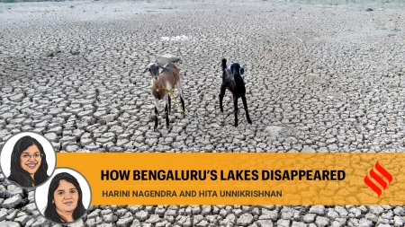
How Bengaluru’s lakes disappearedSubscriber Only

India’s trade with Israel & Iran, and impact of regionalSubscriber Only

Acting is about convincing others, and the best actors can become anyone. Legendary actors like Mammootty, Kamal Haasan, Shah Rukh Khan have played versions of themselves, and now Nivin Pauly is attempting something similar in Varshangalkku Shesham. This takes courage and skill, but it can create a powerful and memorable performance.