The young receptionist at Kathmandu’s Nepal tourist office gaped at me with a quizzical look when I asked about The Indigenous Peoples Trail. It was not a good start to my quest for hiking one of Nepal’s lesser-known treks independently. But I am the stubborn, adventurous type and even if the trail-makers had no idea how to help me, I was resolute about going.
The Indigenous Peoples (IP) Trail is a culture-focused, permit-free, low-altitude trek created jointly in 2011 by the Nepal tourism board and the United Nations in an attempt to increase tourism in the Ramechhap district. This rarely visited region, only 50 miles east of Kathmandu, straddles the Mahabarat, or Lesser Himalaya, range and harbours a mix of Tamang, Newari, Lama, Sherpa, Yolmo, Thami and Majhi peoples – the latter two groups only found in this part of the country.
Regardless, or perhaps because, of its stark difference from the well-trodden high-altitude teahouse treks of the Annapurna, Langtang and Everest base camp, the IP Trail never really took off. I had read that six years after its inception, it had hosted only about 1,000 visitors (a tiny fraction of the 729,550 people who travelled to Nepal in 2016 alone).
And the devastating earthquake that hit the country on 25 April 2015, tearing down the community halls and homestays that served as most trekkers’ accommodation, inflicted the killer blow, pushing the IP Trail into touristic oblivion.
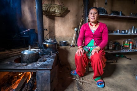
But I wanted to go and see for myself what had happened to its indigenous communities. So, armed with a GPS application and only knowing that it would take me roughly seven days to cover the trail’s 50 miles, I boarded a bus from Kathmandu to Mude. Five hours later, as I got off at the trading town’s main bazaar, a bunch of locals approached the bus with a kicking goat and shoved it into the trunk. They also told me that the only way to reach the IP trail head in tiny Dunghe was to walk for another 10 miles along a barren, trucking road. I hitched the last three miles, ending my first day in a home that doubled as local tavern, truck stop and guesthouse. The owners found me as I entered the village: a basic bed and a warm plate of dal baht, Nepal’s ubiquitous rice and lentils staple, cost me only £3.
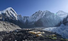
The next morning, I followed the IP Trail’s battered green and white oval sign up the mountain, slogging for about three hours through alpine forest until I reached the rock stupas and fluttering prayer flags at the top of 3,200-metre Sailung peak, the trail’s highest point. On a clear day, this Buddhist site offers glorious views of the Greater Himalayas, a single file of shimmering snow-capped teeth smiling all the way from Annapurna to Everest.

Taking a right path behind sacred Tiger Rock, I started the 43-mile descent that would occupy the best part of my next five days. It was during my lunch stop at Kholakarka, a cluster of simple homes 10 minutes downhill from the peak, that I met a young English-speaking Buddhist nun. Surprised to find me there, she confirmed that the earthquake had not only hit the region hard, it had also interrupted the trickle of tourists that started to bring the locals a side income. She guided me through moss-covered trees to her humble shelter next to the remains of the Bhutanese-style Rajveer monastery, flattened to its foundations, where we spent the night exchanging stories and cups of milky chai around the fireplace.
By mid-afternoon the next day I had walked another 10 miles across terraced green hills to Surke, a few homes nestled at the bottom of a valley blooming with colourful flowers. Surke’s IP Trail-designated guesthouse was the home of Krishna Shresta, the affable local school’s principal. For £5, Krishna offered me a bed and a dinner of dal baht that we ate with ourhands, seated with the family on the kitchen floor. After tea, Krishna showed me his rifle and the skin of a tiger he claimed to have shot in his own backyard.
“Soon we will be able to host more guests,” he explained – though that would require finding funds to replace the old guest rooms destroyed by the earthquake. Truth be told, tourism on the IP Trail had been an invention of Nepal’s tourism bodies, not the locals: a quick look at Krishna’s guestbook testified that, since opening in 2011, his homestay had hosted a maximum of four guests per week, and then only during high season.

By the time I reached the bottom of the Sun Koshi valley three days later, I had passed tiny Galva Bazaar, hiked to the sacred Hindu temple of Khandadevi, witnessed a Buddhist funeral ritual where guests gave up mourning by getting drunk on local moonshine, and overnighted in the delightful Doghme, the village on the trail least affected by the quake. A family offered me room and board with fantastic views over the valley for the now customary £3. There I rested for a day, visiting the village’s small lake, trekking up to the Sunapati panoramic view point, and traipsing around an imposing Buddhist monastery guarded by old lamas.
On my sixth day, when I walked my last miles into Lubughat, I was tired, hungry and in dire need of a shower. But this last village had suffered the worst destruction, and the only place to wash myself was the riverbed. I spent my last night in a cramped room at the back of the rickety corrugated-iron structure opened by a Majhi couple in lieu of the now empty and cracked community hall for tourists.
“We are trying to get Lubughat back on its feet,” the husband apologised to me the next morning. As we talked, on the opposite side of the road a group of local men were cutting up a pig’s carcass. In minutes, the dead animal was transformed into a series of neat piles, each destined to feed a family in the village.
On the bus back to Kathmandu, I had more mixed feelings than when I’d arrived a week earlier. The IP Trail runs through a stunning low-altitude area that’s graced by welcoming people; but most of the villages cannot offer facilities to those travellers who want even a little more than very basic comforts. And with key Unesco world heritage sites in Kathmandu still under renovation, it’s unlikely that Nepal tourism board will be pouring funds into the IP trail anytime soon. So while these indigenous peoples were able to survive an earthquake measuring 8.1 on the Richter scale, now the fate of their trail is in the hands of us visitors. Before you decide to sign up for a classic Annapurna trek, think of Ramechhap, and the difference your money could make there.
Way to go
It’s easy to trek the trail independently, thus contributing directly to the locals’ livelihoods. The easiest way is to start from the trail head at Dunghe and hike downhill to Lubughat. Ramechhap-bound buses run daily to Mude from Kathmandu’s Ratna Park bus station at 6.30am. From the other bend of the river in Lubughat, buses ply the five-hour return trip to Kathmandu via Nepalthok. It’s not necessary to hire a guide, but a porter could help. No need to book accommodation, as the villagers provide homestays along the way. Alternatively, tour operator Nepal Hidden Treks runs organised nine-day group trips on the trail.




Comments (…)
Sign in or create your Guardian account to join the discussion