- News
- City News
- bengaluru News
- What triggered floods, landslides in Kodagu-earthquake or cloudburst?
Trending
This story is from September 2, 2018
What triggered floods, landslides in Kodagu-earthquake or cloudburst?

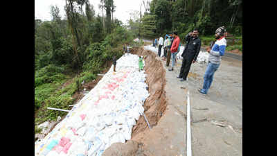
Landslide-hit Kodagu (File photo)
BENGALURU: A fortnight has passed after floods and landslides wreaked havoc in Kodagu, but geologists are still clueless about the exact cause. Residents, however, insist that mild tremors triggered them and blame nearby reservoirs for the calamity.
Adding to the confusion, the newly established seismograph centre at Navodaya Vidyalaya, Galibeedu in Kodagu, has reportedly recorded two mild tremors on August 27 and 28 in its surrounding areas.The findings have been recorded at National Geophysical Research Institute in Hyderabad, but it is yet to establish as to what really caused the disturbance. This has prevented the institute from making an official announcement in their website.
“We experienced mild tremors twice and heard some unusual sounds,” said Kevin Cariappa, a coffee planter in Galibeedu.
GS Srinivas Reddy, director of Karnataka State Natural Disaster Monitoring Centre, claimed that cloudburst at the source of the rivers may have led to floods and that in turn, would have triggered landslide, owing to steepness of its flow. “Kodagu recorded over 100% of excess rains compared to last year. This monsoon naturally triggered a calamity,” he added.
The site of the calamity has since been surveyed by a multi-institutional scientific team from Karnataka State Natural Disaster Monitoring Centre and the Indian Space Research Organisation.
A geologist, who is part of the team, said a lot of debris has accumulated at the site and lack of accessible roads and continuous rain in the area are making their mission difficult.
Dismissing arguments that earthquake has caused floods, Vineet Gahalaut, director of National Institute of Seismology, ministry of environmental sciences, said these tremors are highly localised events which are not created from larger depths and are very shallow. “Such tremors have characteristic feature of losing its energy locally and generally do not travel to larger distances. Many times they are limited to just 10-15km and a maximum of 20km. That’s the reason close monitoring of the region helps in recording ground vibrations that are happening locally,’’ he added.
He said these are tremors of not tectonic related but are happening due to local soil slipping caused by excess pore pressure.
“Plate tectonics is a geological theory that explains the phenomenon of continental drift. There are no plate boundaries in the Indian continent as such. But Himalaya is a plate boundary where India and Tibetan plateau are delineated. These tremors generally carry a magnitude of less than 1.0, preferably of 0.7-0.8 which is not measurable with seismometers located beyond 20km. In most cases, there will be a record of only surface waves which travel on the surface of the earth and carry very mild energies and go undetected,” said Vineet Gahalaut, director, National Institute of Seismology, ministry of environmental sciences.
Adding to the confusion, the newly established seismograph centre at Navodaya Vidyalaya, Galibeedu in Kodagu, has reportedly recorded two mild tremors on August 27 and 28 in its surrounding areas.The findings have been recorded at National Geophysical Research Institute in Hyderabad, but it is yet to establish as to what really caused the disturbance. This has prevented the institute from making an official announcement in their website.
“We experienced mild tremors twice and heard some unusual sounds,” said Kevin Cariappa, a coffee planter in Galibeedu.
GS Srinivas Reddy, director of Karnataka State Natural Disaster Monitoring Centre, claimed that cloudburst at the source of the rivers may have led to floods and that in turn, would have triggered landslide, owing to steepness of its flow. “Kodagu recorded over 100% of excess rains compared to last year. This monsoon naturally triggered a calamity,” he added.
But the residents are not ready to buy this theory. According to them, the land movement and loud noise that began on August 14 are still happening, making it a peculiar geological event.
The site of the calamity has since been surveyed by a multi-institutional scientific team from Karnataka State Natural Disaster Monitoring Centre and the Indian Space Research Organisation.
A geologist, who is part of the team, said a lot of debris has accumulated at the site and lack of accessible roads and continuous rain in the area are making their mission difficult.
Dismissing arguments that earthquake has caused floods, Vineet Gahalaut, director of National Institute of Seismology, ministry of environmental sciences, said these tremors are highly localised events which are not created from larger depths and are very shallow. “Such tremors have characteristic feature of losing its energy locally and generally do not travel to larger distances. Many times they are limited to just 10-15km and a maximum of 20km. That’s the reason close monitoring of the region helps in recording ground vibrations that are happening locally,’’ he added.
He said these are tremors of not tectonic related but are happening due to local soil slipping caused by excess pore pressure.
“Plate tectonics is a geological theory that explains the phenomenon of continental drift. There are no plate boundaries in the Indian continent as such. But Himalaya is a plate boundary where India and Tibetan plateau are delineated. These tremors generally carry a magnitude of less than 1.0, preferably of 0.7-0.8 which is not measurable with seismometers located beyond 20km. In most cases, there will be a record of only surface waves which travel on the surface of the earth and carry very mild energies and go undetected,” said Vineet Gahalaut, director, National Institute of Seismology, ministry of environmental sciences.
End of Article
FOLLOW US ON SOCIAL MEDIA


