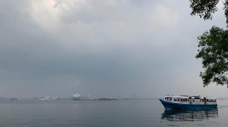
 A cloudy sky in Kochi as Kerala braces for cyclone Fani on Sunday. (Express Photo by Nandagopal Rajan)
Weather forecast today, Cyclone Fani LIVE Updates: The India Meteorological Department (IMD) on Sunday issued a weather warning stating that Cyclone Fani would transform into a severe cyclonic storm. “It is very likely to intensify into a severe cyclonic storm during next 12 hours and into a very severe cyclonic storm during subsequent 24 hours. It is very likely to move northwestwards till 30th April and thereafter recurve northeastwards gradually,” the weather department said in a bulletin issued today.
Cyclone Fani Kerala Live Updates
The IMD had forecast light heavy rainfall at isolated places over Kerala on 29th & 30th April, 2019. Light to moderate rainfall is also likely at few places over north coastal Tamil Nadu & coastal Andhra Pradesh on 30th April & 1st May, 2019.
Fishermen along the coasts of these southern states have been advised not to venture into sea. Those who are in the deep sea areas are advised to return to the coast by Sunday, April 28. A gale is predicted over Southwest Bay of Bengal and adjoining equatorial Indian Ocean with the wind speed ranging between 65-85 kmph.

Cyclonic storm ‘Fani’ over the southeast Bay of Bengal near latitude 8.2°N and longitude 87.0°E about 910 km southeast of Chennai (Tamil Nadu). It will intensify into a severe cyclonic storm in the next 12 hours. Then it will move northeastwards till May 1 evening and thereafter recurve north-northeastwards gradually.
A Sravani, Meteorology Department, Hyderabad said Fani cyclonic storm is going to intensify from severe to very severe cyclonic storm in next 24 hours. Now it's moving northwestward and May 1 onwards, it will move northeastward, reported ANI.
Rain and thundershower with gusty winds to affect over multiple districts of Arunachal Pradesh during the next 12 hours, says Skymet Weather.
Cyclone ‘Fani’ is very likely to intensify into a “severe cyclonic storm” in the next 12 hours and further soar into a “very severe cyclonic storm” in the next 24 hours, the Cyclone Warning Division of the MeT department said on Sunday. In its 1 pm bulletin, the Cyclone Warning Division said ‘Fani’ currently lays over 745 kilometres east-southeast of Trincomalee (Sri Lanka), 1,050 kilometres southeast of Chennai (Tamil Nadu) and 1,230 kilometres south-southeast of Machilipatnam (Andhra Pradesh).
Southern peninsula division comprising all five states of the South India and the Union Territory of Puducherry, Goa and coastal Maharashtra, the rainfall deficiency recorded was 31 per cent, the IMD said. East and northeast India division recorded 23 per cent deficiency. The Central India division is the only one to have recorded more five per cent rainfall than the normal. Pre-monsoon showers, thunderstorms and lightening have killed more than 50 people in Madhya Pradesh, Maharashtra, Gujarat and Rajasthan this month. (PTI)
Pre-monsoon rainfall from March to April, a phenomenon critical to agriculture in some parts of the country, has recorded 27 per cent deficiency, according to the India Meteorological Department (IMD). The IMD recorded 43.3 millimetres of rainfall across the country from March 1 to April 24 as against the normal precipitation of 59.6 millimetres. This was 27 per cent less of the Long Period Average (LPA). The highest deficiency of 38 per cent was recorded in the northwest India division of the IMD, which comprises states of Uttar Pradesh, Delhi, Punjab, Haryana, Jammu and Kashmir, Uttarakhand, Himachal Pradesh. (PTI)
Balachandran also stated that Fani will slowly change its direction after May 1.
Fani is likely to intensify into severe cyclone storm tonight & very severe cyclonic storm by tomorrow, said S Balachandran of IMD Chennai.
In a mixed weather forecast for Telangana, the Met department has issued heatwave warning for two days from Sunday in some parts while predicting moderate rain in isolated places in the state. In a respite from scorching heat with temperature hovering over 40 degree Celsius mark in the past few days, the city experienced cloudy sky Sunday, reports PTI.
According to the India Meteorological Department here, heat wave conditions are likely to prevail in some parts of Telangana Sunday and Monday. It also forecast that light to moderate rain or thunder showers were very likely to occur at isolated places in the state.
On Saturday, Adilabad sizzled with a maximum temperature of 45.3 degree Celsius, the highest in the state, followed by Nizamabad 44.5 degree Celsius while Hyderabad recorded 41 degree Celsius.
The parts of South Karnataka and Kerala have been experiencing light rains and thundershowers for the last few days. According to the data available with Skymet, during the last 24 hours, Kozhikode in Kerala has recorded 2 mm of rainfall, while traces of rain have been recorded in Gadag, Karnataka.
The reason for these activities can be attributed to the trough, which is extending from Central Madhya Pradesh up to North Kerala. In addition to this trough, a cyclonic circulation has formed over the coastal areas of South Karnataka and adjoining Arabian Sea. Both the systems are oscillating almost close to periphery, thereby giving rains.
As the systems will persist for some more time, rain and thundershowers will continue over few parts of south and coastal Karnataka and Kerala for the next 48 hours. Thus, we expect light to moderate rain and thundershowers, along with isolated moderate spell, accompanied with strong gusty winds over Mysore, Bengaluru, Mangaluru, Chitradurga, Chamarajanagar, Thiruvananthapuram, Kannur, Kozhikode and Kochi for next two days. This will commence today late afternoon or evening onwards.
The weatherman Sunday forecast mainly clear sky and strong surface winds in the city where the minimum temperature settled at 25.4 degrees Celsius, one notch above the season's average, reports PTI.
The maximum temperature is likely to be 41 degrees Celsius. The relative humidity in the morning was recorded at 36 per cent.
The Safdarjung observatory, the recording of which is considered the official figure for the city, registered a maximum temperature of 40.7 degrees Celsius on Saturday while the minimum was recorded at 25.4 degrees Celsius.
The cyclonic storm ‘FANI’ (pronounced as ‘FONI’) over southeast Bay of Bengal & neighbourhood moved north-northwestwards with a speed of about 13 kmph in the early hours of April 28 and lay centred at 0530 hrs IST of 28th April, 2019 near latitude 7.3°N and longitude 87.9°E over southeast Bay of Bengal & neighbourhood, about 745 km east-southeast of Trincomalee (Sri Lanka), 1050 km southeast of Chennai (Tamil Nadu) and 1230 km south-southeast of Machilipatnam (Andhra Pradesh).
It is very likely to intensify into a Severe Cyclonic Storm during the next 12 hours and into a Very Severe Cyclonic Storm during subsequent 24 hours. It is very likely to move northwestwards till 30th April and thereafter recurve northeastwards gradually.
Cyclonic storm Fani is now all set to become powerful as it is expected to intensify into a severe cyclonic storm by Sunday afternoon.
Formed in the south-east Bay of Bengal, it will intensify into a severe cyclone by this afternoon. It is again expected to further intensify into a very severe cyclone by tomorrow evening. Currently, Cyclone Fani is moving in a north-west direction, centred at 1,110 kilometres south-east of Chennai and 1,300 km away from Machilipattinam.
Many places in Kerala are expected to get light to moderate rain on Monday and Tuesday, with heavy rainfall at a few places. North coastal Tamil Nadu and coastal Andhra Pradesh are set to get light to moderate rain at a few places on Tuesday and Wednesday.
According to an IMD forecast, strong wind speed reaching 30-40 kmph gusting to 50 kmph likely to commence along and off Tamilnadu and Puducherry coast, Comorin area and Gulf of Mannar from April 28 morning, becoming squally wind speed reaching 40-50 kmph gusting to 60 kmph from 29 th morning.
It is very likely to become squally wind speed reaching 50-60 kmph gusting to 70 kmph from 30th morning along north Tamilnadu, Puducherry and south Andhra Pradesh Coasts.
Strong wind speed reaching 30-40 kmph gusting to 50 kmph likely to commence along & off Kerala coast from 28th evening and becoming squally wind speed reaching 40-50 kmph gusting to 60 kmph on 29th & 30th.
The sea condition is very high over Southeast Bay of Bengal & neighbourhood. It is very likely to become very high to phenomenal over Southwest Bay of Bengal from 29th morning and phenomenal over southwest & adjoining westcentral Bay of Bengal, off north Tamilnadu, Puducherry and south Andhra Pradesh Coasts from 30th night.
Sea conditions very likely to be rough to very rough along & off Puducherry, Tamilnadu and south Andhra Pradesh Coasts from 29th April to 1st May 2019 and westcentral Bay of Bengal off Andhra Pradesh Coast on 2nd May.
Sea condition will be rough to very rough from April 29. Fishermen are advised not to venture into sea from April 28. Those at sea are advised to return to port immediately, said Duty Officer, Cyclone Warning Centre, Vishakhapatnam.
Heat wave in parts of Gujarat will continue over the next two days, IMD has said. The maximum temperature in Ahmedabad touched 43.6 degree Celsius, 2.3 degrees above normal yesterday, and is very likely to touch 24 degree Celsius in the coming days, reports PTI.
The heat, though tolerable, could cause "moderate health concern for vulnerable people, that is, infants, elderly, and people with chronic diseases", the Met department said.
The meteorological centre in Bhubaneswar, Odisha has issued heat wave warning in nine districts of the state as temperatures soared above 40 degrees in at least 14 places.
The weather warning was issued yesterday for three days from Saturday in Jharsuguda, Sambalpur, Kalahandi, Bolangir, Malkangiri, Bargarh, Sonepur, Nuapada and Boudh districts.
The Deep Depression over Southeast Bay of Bengal has intensified into a Cyclonic Storm Fani
Gale wind speed reaching 80-90 kmph gusting to 100 kmph is prevailing over Southeast Bay of Bengal & neighbourhood, an IMD report said. It is very likely to become 90-100 kmph gusting to 115 kmph from April 28 morning over the same area; 120-130 kmph gusting to 145 kmph over Southwest Bay of Bengal from 29th morning and 145-155 kmph gusting to 170 kmph over southwest & adjoining westcentral Bay of Bengal off north Tamilnadu, Puducherry and south Andhra Pradesh Coasts from 30th night. It is likely to decrease gradually thereafter with gale wind speed reaching 125-135 kmph gusting to 150 kmph over westcentral Bay of Bengal off Andhra Pradesh Coast on 2nd May 2019.