Trending
This story is from June 11, 2019
Cyclone Vayu to slow down monsoon progress over Marathwada, Vidarbha
The monsoon may reach the extreme parts of south Maharashtra after June 13 — almost five days after its normal date — because cyclonic storm Vayu (the name given by India) could slow down its progress.

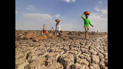
Drought-hit Marathwada region
Key Highlights
- The normal date of monsoon arrival in these areas is June 7
- The delay would worsen the current situation in these regions, already facing acute water shortage
PUNE: The monsoon may reach the extreme parts of south Maharashtra after June 13 — almost five days after its normal date — because cyclonic storm Vayu (the name given by India) could slow down its progress.

The normal date of monsoon arrival in these areas is June 7. The cyclonic storm started developing from Tuesday morning.
Officials of the India Meteorological Department (IMD) said the advent of the monsoon over the southern parts of Konkan-Goa and Madhya Maharashtra might be quick, but its onset over Marathwada and Vidarbha could be further delayed.This would partially worsen the current situation in these regions, already reeling from a heatwave and facing acute water shortage.
This means the cyclonic storm would delay the monsoon’s progress after its late arrival in Kerala, delaying its onset over other parts of south peninsular India and parts of Maharashtra. “The monsoon current is very young right now and is still in the process of being strengthened,” said Kashyapi.
In addition, westerly winds with its jet core are still very strong (as frequent western disturbances are forming), preventing the monsoon from further penetration into the south peninsular India,” he said.
He said the northern limit of monsoon made minimal progress on Monday. “While monsoon progressed slightly on the southern-west coast, it failed to simultaneously progress over the mainland, including Tamil Nadu, interior Karnataka and Andhra Pradesh. As per current conditions, the progress of monsoon will continue to be hampered till the landfall of the cyclonic storm Vayu around June 13-14,” said Kashyapi.
He said areas of Konkan and south Maharashtra will continue to get pre-monsoon rain during June 11-13, making conditions favourable for the monsoon onset. “But the issue will be the lack of rainfall during that time over interior Karnataka and Andhra Pradesh. With that scenario, the monsoon onset over those parts (interior Karnataka and AP) cannot be declared. Also, until monsoon covers these regions in the south peninsular India, its onset and progress over Maharashtra and other parts of the peninsular India cannot be declared for maintaining the spatial continuity of monsoon,” he said.

The normal date of monsoon arrival in these areas is June 7. The cyclonic storm started developing from Tuesday morning.
Officials of the India Meteorological Department (IMD) said the advent of the monsoon over the southern parts of Konkan-Goa and Madhya Maharashtra might be quick, but its onset over Marathwada and Vidarbha could be further delayed.This would partially worsen the current situation in these regions, already reeling from a heatwave and facing acute water shortage.
Anupam Kashyapi, head of weather, IMD Pune, told TOI that the low pressure over the Arabian Sea had become a deep depression and was likely to turn into a cyclonic storm (to be christened Vayu) on Tuesday morning. “The cyclonic storm will draw moisture from interior Karnataka and Andhra Pradesh, thus slowing its (the monsoon’s) progress over interior Karnataka and south peninsular India,” he said.
This means the cyclonic storm would delay the monsoon’s progress after its late arrival in Kerala, delaying its onset over other parts of south peninsular India and parts of Maharashtra. “The monsoon current is very young right now and is still in the process of being strengthened,” said Kashyapi.
In addition, westerly winds with its jet core are still very strong (as frequent western disturbances are forming), preventing the monsoon from further penetration into the south peninsular India,” he said.
He said the northern limit of monsoon made minimal progress on Monday. “While monsoon progressed slightly on the southern-west coast, it failed to simultaneously progress over the mainland, including Tamil Nadu, interior Karnataka and Andhra Pradesh. As per current conditions, the progress of monsoon will continue to be hampered till the landfall of the cyclonic storm Vayu around June 13-14,” said Kashyapi.
He said areas of Konkan and south Maharashtra will continue to get pre-monsoon rain during June 11-13, making conditions favourable for the monsoon onset. “But the issue will be the lack of rainfall during that time over interior Karnataka and Andhra Pradesh. With that scenario, the monsoon onset over those parts (interior Karnataka and AP) cannot be declared. Also, until monsoon covers these regions in the south peninsular India, its onset and progress over Maharashtra and other parts of the peninsular India cannot be declared for maintaining the spatial continuity of monsoon,” he said.
End of Article
FOLLOW US ON SOCIAL MEDIA


