- India
- International
Wednesday, Apr 24, 2024
Journalism of Courage
 IMD officials said monsoon was in the process of intensifying and good rainfall was expected in many parts of the country in the next few days.
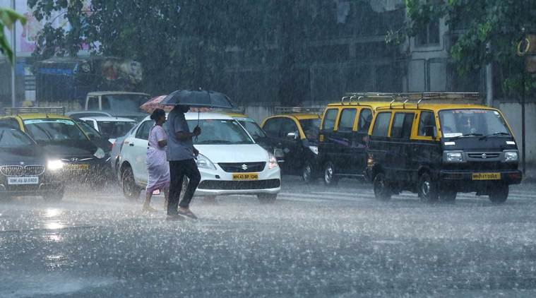
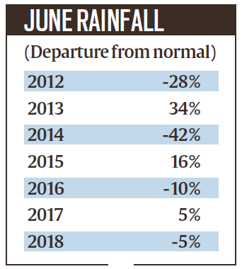
Due to late onset and the adverse impact of Cyclone Vayu, the first month of the monsoon season ended with a 32.8% deficiency in rainfall for the country as a whole — the worst in the last five years. But the months of July and August promise to be better, according to the India Meteorological Department (IMD).
IMD officials said monsoon was in the process of intensifying and good rainfall was expected in many parts of the country in the next few days. As per the latest forecasts, a low pressure system that lay over Odisha as on July 1 is expected to cause widespread rainfall across Odisha, Telangana, Andhra Pradesh and Maharashtra over the next four days (till July 6) starting Tuesday (July 2). Besides compensating for the deficit, this would also aid the further advancement of monsoon to cover the remaining parts of central, western and northern India by the end of this week.
The June deficiency was the worst since 2014, which saw a deficit of 42%. The rainfall in June last year was 5% below normal.
Explained: What the delay in onset of monsoon means for India
This year, the onset of monsoon over the Kerala coast was delayed by a week, and then Cyclone Vayu, which approached the Gujarat coast in the second week of June, halted the northward progress of the monsoon by another week. Some rainfall towards June-end ensured that the deficit dropped from 43% on June 19, to 36% on June 26, and less than 33% now.

 As many as 30 of the 36 meteorological sub-divisions recorded below-normal rainfall in June.
With about 18% contribution, June accounts for the least amount of rainfall during the four-month monsoon season. July and August see the heaviest rainfall — accounting for about 33% and 30% respectively of the total rainfall.
IMD officials said the conditions were favourable for further northward progression of the monsoon in the coming days, and it would reach Delhi around July 4-5. On Monday, the Northern Limit of Monsoon (NLM) passed through Dwarka, Ahmedabad, Bhopal, Jabalpur, Pendra, Sultanpur, Lakhimpur Kheri and Mukteshwar.
Rain check: What held the monsoon back, what is the forecast ahead?
IMD said El Nino, though weak this year, could also have played a role in the below-normal rainfall in June. El Nino is the abnormal warming of the equatorial Pacific Ocean that is known to suppress Indian summer monsoon.
“While the El Nino is weakening, it may have played some role in slowing down the progress of monsoon after the onset. However, we still cannot ascertain it to be the sole cause for the rain deficit,” said an IMD official.
Among the driest states in June were Maharashtra, Andhra Pradesh, Telangana, Kerala and large parts of the North-East where the actual rainfall was 30% to 60% below normal.
Also Read | Rain deficiency at 50 per cent, Punjab records first dry June since 2014
As many as 30 of the 36 meteorological sub-divisions recorded below-normal rainfall in June. The only ones with normal rainfall were north interior Karnataka, Konkan and Goa, Gujarat, east Rajasthan and Jammu and Kashmir.

I met nobody in rural India who saw Modi asSubscriber Only

India’s trade with Israel & Iran, and impact of regionalSubscriber Only
As Lok Sabha polls begin, it’s over to the youngSubscriber Only

'Only Modi can shoulder task of PM for third term':Subscriber Only

'7% is not an adequate growth rate, India ought toSubscriber Only
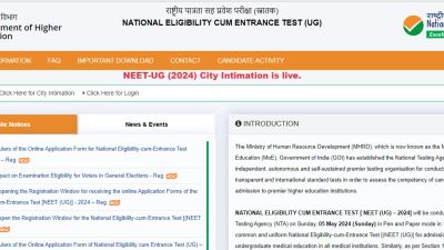
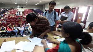
NTA released the city intimation slip for NEET UG 2024 on April 24, with the exam scheduled for May 5 in 13 languages. This time, 23 lakh candidates registered for the exam scheduled, of which over 10 lakh are male students, over 13 lakh are girls and 24 students have registered under the ‘third gender’ category. City slips available at exams.nta.ac.in/NEET/.