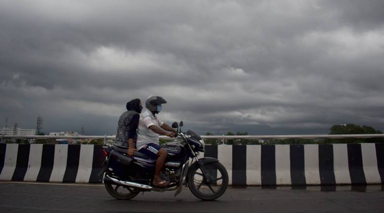
 The country will witness no significant change in maximum temperature during the next 24 hours.(PTI/File)
Weather Forecast Highlights: The cyclonic circulation of over east central Bay of Bengal extending upto mid-tropospheric level continues to persist, the Indian Meteorological Department said on Monday. Due to this, a low pressure area is likely to form over this region in the next 48 hours. The low pressure area will presumably move west-northwest wards and become more profound in the subsequent 24 hours.
This low pressure area is expected to cause fairly widespread and isolated rainfall over Odisha, north Coastal Andhra Pradesh, Telangana and isolated heavy falls over Vidarbha, Gangetic West Bengal, Gujarat and south Madhya Pradesh in the next 2 to 3 days.
The World Meteorological Organisation lauded the timely and accurate prediction of cyclone Amphan, the second super cyclone to have formed over Bay of Bengal in two decades by the Indian Meteorological Department.
The weather department further said that the country will witness no significant change in maximum temperature during the next 24 hours and the temperatures will rise by 2°C to 4°C thereafter over northwest India. No significant change in maximum temperatures likely over the rest parts of the country during the next 4-5 days, it added.
Meanwhile, conditions are becoming favourable for the further advancement of Southwest Monsoon in Goa, parts of Arabian sea, Konkan, Karnataka, Rayalaseema, Tamil Nadu,Coastal Andhra Pradesh, some more parts of Central and North Bay of Bengal and some parts of Northeastern during next 2 days.

The mercury in the national capital remained below the 40 degrees Celsius-mark on Monday and is expected to rise by a few notches in the next few days. The Safdarjung Observatory, which provides representative figures for the city, recorded a maximum of 37.6 degrees Celsius, which was three notches below normal. On Sunday, it recorded a high of 34.8 degrees Celsius, which was five notches below normal. The weather stations at Palam and Lodhi Road recorded their respective maximum temperatures at 38.6 and 37.6 degrees Celsius. Humidity levels oscillated between?43 and 88 per cent. PTI
The India Meteorological Department (IMD) has forecast thunderstorms accompanied by lightning and winds reaching 30-40 kmph at isolated places in Mumbai, Thane, and Palghar during June 10-12. For Tuesday, the Met department forecast a generally cloudy sky with possibility of rain in the city and suburbs.
Maharashtra has been receiving pre-monsoon showers. Mumbai’s Santacruz observatory recorded 19.1 mm rain in the last 24 hours whereas Colaba station recorded 27 mm rain at 8:30 am on Monday. The Air Quality Index continued to be in the ‘good category’ on Monday evening.
The Southwest monsoon is likely to make an onset over Maharashtra in the next two-three days. The monsoon on Sunday advanced to parts of Karnataka and more areas of Tamil Nadu. “Conditions are becoming favourable for the advancement of monsoon into parts of south Konkan during the next two-three days,” the IMD said. According to the revised monsoon onset dates released by IMD, the onset over Maharashtra is likely from June 10 onwards.
The maximum temperatures went up slightly across the states in north India on Monday but settled well below normal limits for this time of the year after isolated places in the region witnessed light rains. The India Meteorological Department (IMD) said there were scattered rains or thundershowers across these states till Monday morning. It said the maximum temperatures were likely to rise by 2-4 degrees in northwest and central India in the next two-three days.
No significant rise in the mercury is likely in the rest of the country during the next three-four days, it added.The weather office said strong winds were expected over southwest and west-central Arabian Sea, south and east-central Bay of Bengal and off and along the Andhra Pradesh coast on Tuesday. It advised fishermen not to venture into the sea in these areas.
In Delhi, the mercury settled at 37.6 degrees Celsius, three notches below normal, on Monday and is expected to rise by a few notches in the coming days.
The maximum temperatures in Haryana and Punjab registered a slight increase on Monday but the mercury settled well below the normal limits. Chandigarh, the common capital of the two states, recorded a high of 35.7 degrees Celsius, three notches below normal, according to the Meteorological Department. In Haryana, Ambala recorded a maximum of 35.7 degrees Celsius, three notches below normal, while it was 35 degrees Celsius in Karnal, four notches below normal. Hisar's maximum settled at 39.5 degrees Celsius, three notches below normal while Narnaul registered a high of 38 degrees Celsius, five notches below normal. Amritsar in Punjab recorded a maximum temperature of 37 degrees Celsius, three notches below normal limits.
A Low-Pressure Area is likely to develop over the east-central Bay of Bengal during next 24 hours. It is likely to move west-northwest wards and become more marked during subsequent 24 hours, said India Meteorological Department (IMD)
As a consequence of the formation of a low pressure area over parts of Bay of Bengal in the next 48 hours, parts of central and south India are expected to experience heavy showers over the next few days.
*Isolated heavy falls are likely over north Madhya Maharashtra, Marathwada, Vidarbha, Chhattisgarh and south Madhya Pradesh during 11th-12th June.
*Similarly, isolated heavy to very heavy rainfall is likely over Odisha, north Coastal Andhra Pradesh, Telangana, Coastal Karnataka, north Konkan and Kerala & Mahe during 10th-12th June.
The World Meteorological Organisation lauded the timely and accurate prediction of cyclone Amphan, the second super cyclone to have formed over Bay of Bengal in two decades by the Indian Meteorological Department .
Ministry of Earth Sciences Monday warned of the possible health deterioration due to a heat wave and issued precautionary measures to combat the same.
According to the Minsitry of Earth Sciences heat waves can casue dehydration, heat cramps, heat exhaution as well as heat strokes.
The Ministry of Earth Sciences(MoES) issued heat wave guidelines on Monday suggesting precautions to be taken during different stages of a heat wave.
*Thunderstorms accompanied with lightning & gusty winds (speed reaching 40-50 kmph) at isolated places are very likely over Andaman & Nicobar Islands.
*More thunderstorms with lightning and winds reaching 30 to 40 kmph over Gujarat, Rajasthan, Odisha and Gangetic West Bengal.
*Thunderstorms with lightning over Madhya Pradesh, Vidarbha, Chhattisgarh, Bihar, Jharkhand, Sub-Himalayan West Bengal & Sikkim, Arunachal Pradesh, Assam & Meghalaya, Nagaland, Manipur, Mizoram & Tripura, Coastal Andhra Pradesh & Yanam, Telangana, Rayalaseema, Tamilnadu, Puducherry & Karaikal and North Interior Karnataka.
*Heavy rainfall at isolated places is very likely over Coastal Andhra Pradesh & Yanam and Kerala & Mahe.
With the likely formation of a low pressure area over east central Bay of Bengal by Tuesday, Monsoon is set to advance into West Bengal, Odisha, Sikkim and some parts of northeastern states by June 11-12, the Met department said here on Sunday.
"Due to the formation of the low pressure area, conditions are likely to become favourable for advance of Southwest Monsoon into some parts of northeastern states, Sikkim, Odisha and West Bengal during June 11-12," regional Met director G K Das said.
Rain lashes in parts of Rajasthan and Karnataka - Several parts of Rajasthan recorded rainfall in the last 24 hours. IMD has predicted strong winds with thunderstorms over several districts in the next 24 hours. Karnataka's Kodagu district also experienced rain Sunday leading to waterlogged streets.
Mercury drop in Delhi, Haryana and Punjab- The national capital witnessed another bout of light rain on Sunday which brought the mercury below 35 degrees Celsius. Partly cloudy sky and strong surface winds (up to 30 kmph) are likely to occur today. The maximum temperature at several places in Haryana and Punjab settled around 7 to 12 notches below the season's average.
With a low pressure area shaping up over the Bay of Bengal, the IMD Sunday predicted a prolonged rainfall warning in Odisha with heavy to very heavy rainfall in many areas in next three days.
On Monday, thunderstorm with lightning and accompanied by gusty surface wind may occur in some places over Keonjhar, Mayurbhanj, Sundargarh, Balasore, Bhadrak, Jajpur, Cuttack, Deogarh, Sambalpur, Jharsuguda, Sonepur, Boudh, Kandhamal, Angul, Dhenkanal, Bargarh, Nayagarh, Ganjam, Balangir, Ganjam, Gajapati, Koraput, Malkangiri, Rayagada and Nabarangpur districts.
In view of the weather condition, the MeT centre has issued a yellow warning for many districts from Monday till June 10 and orange warning for several others on June 11.
The cyclonic circulation over north Punjab & neighbourhood (extending upto 1.5 km above mean sea level), northeast Uttar Pradesh & neighbourhood (upto 0.9 km above mean sea level) and over Central Gujarat (between 2.1 km & 3.1 km above mean sea level) persists, IMD’s daily bulletin read.
The weather dept. said that the country will witness no significant change in maximum temperature during the next 24 hours and the temperatures will rise by 2°C to 4°C thereafter over northwest India. No significant change in maximum temperatures likely over the rest of the country during the next 4 to 5 days, it added.
Welcome to our weather forecast live blog. The low pressure area over Bay of Bengal is expected to cause fairly widespread and isolated rainfall over Odisha, north Coastal Andhra Pradesh, Telangana and isolated heavy falls over Vidarbha, Gangetic West Bengal, Gujarat and south Madhya Pradesh in the next 2 to 3 days.