- India
- International
Friday, Apr 26, 2024
Journalism of Courage
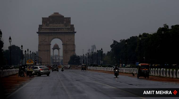 Weather forecast Today: Rain lashed parts of Delhi on Wednesday.
Weather forecast Today: A day after Delhi witnessed moderate to heavy rainfall, the Indian Meteorological Department (IMD) Thursday predicted that intense showers will continue in isolated pockets of the national capital for the next 24 hours.
Due to approaching cloud clusters from the north-northwestward direction, the weather bureau’s Delhi department has indicated that thunderstorms accompanied with moderate to heavy rains and gusty winds are likely to occur over large parts of Delhi, Gurugram, Noida, and Greater Noida over the next two hours.
— RWFC New Delhi (@RWFC_ND) July 30, 2020
“Delhi-NCR is very likely to experience moderate rain with a spell of heavy rainfall (more than 65mm) during today’s midnight to 30 July 2020,” the IMD warned in a weather update released late Wednesday night.
On Wednesday, the showers brought relief to the people of Delhi from the sultry weather but caused waterlogging in low-lying areas, affecting traffic movement, electricity and water supply.
— RWFC New Delhi (@RWFC_ND) July 29, 2020
Meanwhile, due to a shifting monsoon trough and multiple cyclonic circulations, the IMD has predicted downpour over the rest of north India as well. Isolated heavy to very heavy rains are expected over Uttarakhand, Uttar Pradesh, Punjab, Haryana, Rajasthan and Madhya Pradesh over the next 24 hours.
Moderate to severe thunderstorms accompanied with lightning are also likely to occur over Jammu and Kashmir, Himachal Pradesh, south Uttar Pradesh, Bihar and Andhra Pradesh during the next 12 hours, according to IMD’s daily weather bulletin.
Fairly widespread rainfall/ thundershowers are expected along India’s west coast. Heavy to very heavy rainfall is predicted in Kerala, coastal and south interior Karnataka, Gujarat, parts of Maharashtra, Konkan and Goa.

 Weather forecast Today: A woman covers herself with a plastic sheet during rainfall in Delhi on Wednesday.
On Wednesday, heavy rains lashed parts of Kerala inundating low lying areas and partially disrupting rail and road traffic. Following this, the IMD issued a red alert for Kerala’s high-range Idukki district with a forecast of widespread extremely heavy showers. Malappuram, Kozhikode, Wayanad, Kannur and Kasaragode have been put on orange alert for the rest of the day.
The IMD has also predicted squally weather, with wind speeds reaching 40-50 kmph, over the Andaman sea, Gulf of Mannar and along and off the Kerala-Karnataka coasts and Lakshadweep areas. Fishermen have been warned to stay off the water in these regions.
Meanwhile, six people died in Assam and Bihar on Wednesday due to floods which have affected over 55 lakh people in the two states so far.
Also, the highest maximum temperature of 42.4° C was recorded in Rajasthan’s Ganganagar on Wednesday, while the lowest minimum temperature of 18.6° C was reported in Chandrapur, Vidarbha. No significant change in temperatures is likely over most parts of the country during the next 3-4 days, IMD said.
Light to moderate rainfall and thundershowers occurred at many places in Uttar Pradesh with heavy showers at isolated places in the past 24 hours, the Meteorological department said on Thursday. Thunderstorm accompanied with lighting occurred at isolated places over the state, it said.
Sardanagar in Lakhimpur Kheri district received maximum of 11 cm rains followed by Nakur (Saharanpur) with 9 cm; Kakrahi (Siddharthnagar) and Najibabad (Bijnore) with 7 cm each; Chandredeepghat (Gorakhpur) with 6 cm; Karchana (Allahabad), Kunda (Pratapgarh), Dhampur (Bijnore) and Puranpur (Pilibhit) with 5 cm each.
The department has forecast rain/thundershower to be very likely at many places over the state and warned that heavy rains are very likely at isolated places over the state on Friday. According to the Central Water Commission, Ghaghra river was rising in Ayodhya and Elgin Bridge along with Rapti river in Balrampur and Bansi.
A report from Gonda district said the Ghaghra river was flowing above the danger mark at Elgin Bridge after water was released from Girja and Sharda barrages. The district administration has taken note of the situation and is in the process of making necessary preparations to deal with any eventuality of a flood-like situation in the near future, officials in Gonda district said.
Additional District Magistrate Rakesh Singh said water was released on Thursday in Ghaghra river. He said 23 flood outposts in Karnalganj and Tarabganj townships have been put on alert and the situation was under control as of now with no village facing any problem.