Did any of us expect the COVID-19 pandemic to last as long as it has? Probably not, but here we are.
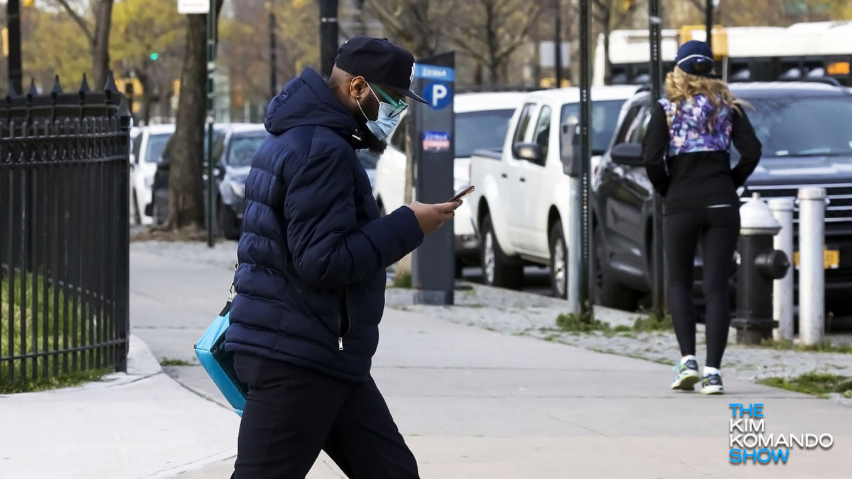
Dealing with the unseen viral threat has changed quite a bit about how we live over the last several months. Masks are a regular part of most of our lives, as are other tools, like hand sanitizer and social distancing. Tap or click here to see some new tech that has emerged.
Another tech tool is been added to our arsenal in the fight against COVID via Google Maps. If you’re a Google Maps user, this new tool will help you safely navigate and avoid areas that are hotspots for the virus. Here are details on what it is and how it works.
New COVID hotspot tracker
Google is introducing new helpful COVID data in Google Maps. This tool will show you important information about COVID-19 cases in your area (and areas you’re traveling to) so you can make informed decisions on what’s safe. Google plans on rolling this feature out this week.
RELATED: Genius DIY project for a safe and fun Halloween
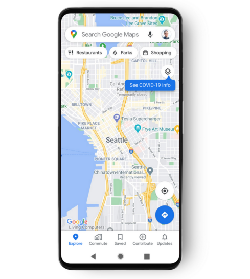
Here’s how it works: Begin by opening Google Maps. Tap on the layers button on the top right hand corner of your screen and click COVID-19 info.

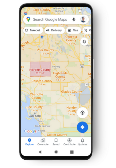
You’ll then see a seven-day average of new COVID cases per 100,000 people for the area you’re looking at along with a label that shows whether cases are trending up or down.
Color coding will help you easily determine which areas are hotspots and places to avoid. Here are the six different colors displayed, each noting a different data set:
- Grey: Less than 1 case
- Yellow: 1-10 cases
- Orange: 10-20 cases
- Dark orange: 20-30 cases
- Red: 30-40 cases
- Dark red: 40+ cases
Google is pulling data from multiple sources for this feature: Johns Hopkins University, “New York Times,” and Wikipedia — all of which receive data from the World Health Organization and other public or government health organizations. In fact, many of these sources already power Google’s COVID case information in Search.
When this new feature is rolled out, it will include information for all 220 countries that Google Maps works in. The new feature will also include information on the state, province, county and city-level where available.
This feature will be available on iOS and Android versions of Google Maps. Google stated in a blog post about the feature that it “hopes that these Google Maps features will help you get where you need to be as safely and efficiently as possible. The COVID layer starts rolling out worldwide on Android and iOS this week.”
Once the feature is available on your phone, you’ll need to to turn it on in Google Maps to use it.
Related: Here’s what Google and Apple’s COVID-19 exposure app could look like
To turn on COVID-19 layer in Google Maps:
You can view COVID-19 related information as a layer in Google Maps.
- On your mobile device, open Google Maps.
- At the top, tap Layers > COVID-19 info.
Once the layer is turned on, the available COVID information will appear whenever you’re using the Google Maps.
This is one of several COVID-related features Google has introduced. In recent months, the tech giant has also rolled out safety-related COVID features on Google Maps for popular times and live busyness, COVID-19 alerts in transit, and COVID checkpoints in driving navigation.