- News
- City News
- Hyderabad News
- NIT-Warangal experts’ warning on Falaknuma flooding ignored
Trending
This story is from October 24, 2020
NIT-Warangal experts’ warning on Falaknuma flooding ignored
NIT-Warangal researchers had published a paper in December 2019 stating that Falaknuma and Malakpet are highly flood-prone after a scientific study.

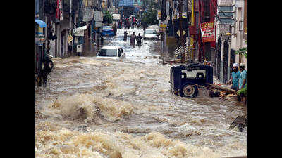
On October 14, Falaknuma was the worst hit among flood-affected areas in the city
HYDERABAD: NIT-Warangal researchers had published a paper in December 2019 stating that Falaknuma and Malakpet are highly flood-prone after a scientific study. On October 14, Falaknuma was the worst hit among flood-affected areas in the city resulting in loss of human lives, displacement of families and inundation of several colonies.
The NIT study “Visualisation of urban flood inundation using SWMM and 4D GIS” published in ‘Springer’ journal was taken up for flood inundation mapping using stormwater management model and four-dimensional geographic information system.NIT civil engineering experts took up the study in Chanchalguda, Malakpet, Durganagar, Falaknuma and a few other colonies in the southern parts of the Musi river in an area of 91 square km. NIT experts — PZ Seenu, E Venkata Rathnam and KV Jayakumar — conducted series of on ground and digital model evaulations. Jayakumar, one of the authors of the study, said: “Drainage network exists only in a small portion of zone V of the city where the study has been taken up. We have identified the drainage network extending from Malakpet to Falaknuma as the flood-prone region. The inundated area consists of landed properties and residential areas.” He said there was no inundation in the upstream part of the study area due to the presence of water bodies and steep slopes.
“We used software packages, SWMM and ArcGIS and flood inundation map for study area in Hyderabad has been prepared by combining run-off depth with respect to time, peak discharge and digital evaluation Model. Areas which are likely to be inundated in study area for different rainfall durations were found out using flood inundation map,” they said.
Researchers said that the study presents a methodology to prepare the 4D flood inundation for the study area which will be useful for early determination of flood propagation
End of Article
FOLLOW US ON SOCIAL MEDIA


