

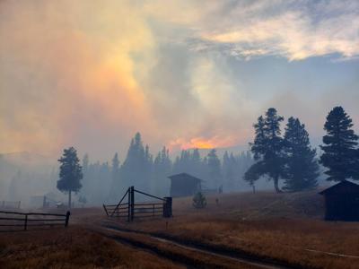


The snow that fell early in the week continues to be a major factor in helping the fight against Colorado's wildfires.
Here's the latest on the acreage and containment of the various fires that have been active during recent days around Colorado, according to InciWeb.
Editor's Note: This list is based on the most recent update posted to emergency notification website InciWeb. Some of the fires included on this list have been fully contained. The status of a wildfire is subject to rapid change. Check with the InciWeb website for the most up-to-date information.
1. Cameron Peak Fire
Location: 15 miles southwest of Red Feather Lakes, northern Rocky Mountain National Park
Size: 208,663 acres
Containment: 64 percent
No growth or containment change since our October 26 report.
2. East Troublesome Fire
Location: Grand County, Rocky Mountain National Park
Size: 192,560 acres in the western 'Grand zone' near Grand Lake; 4,346 acres in the 'Thompson zone' near Estes Park
Containment: 20 percent in Grand Zone, 0 percent in Thompson Zone
Slight uptick in containment in Grand Zone. No reported growth in either zone compared to our October 26 update.
3. Mullen Fire
Location: 38 miles west of Laramie
Size: 176,878 acres
Containment: 85 percent
No update compared to our October 26 update.
4. Pine Gulch Fire
Location: Near Grand Junction
Size: 139,007 acres
Containment: 100 percent
No update compared to our October 26 update.
5. Grizzly Creek Fire
Location: Near Glenwood Springs
Size: 32,631 acres
Containment: 91 percent
No update compared to our October 26 update.
6. Middle Fork Fire
Location: 10 miles north of Steamboat Springs
Size: 20,433 acres
Containment: 30 percent
Jump from 12 percent to 30 percent containment compared to our October 26 update.
7. Williams Fork Fire
Location: 9.5 miles southwest of Fraser
Size: 14,749 acres
Containment: 35 percent
Five percent containment jump compared to our October 26 update.
8. Calwood Fire
Location: 3 miles northwest of Jamestown in Boulder County
Size: 10,105 acres
Containment: 76 percent
No update on size or containment compared to our October 26 update. Command of the blaze has been transferred to a unified command comprised of the Arapahoe and Roosevelt National Forests and the Boulder County Sheriff's Office fire management.
9. Ice Fire
Location: 5 miles west of Silverton
Size: 596 acres
Containment: 100 percent
This fire is now fully contained compared to our October 26 update when it was at 95 percent containment.
10. Lefthand Canyon Fire
Location: 1 mile east of Ward in Boulder County
Size: 460 acres
Containment: 100 percent
No update compared to our October 26 report.
11. Thorpe Fire
Location: 9 miles northwest of Lake George
Size: 159 acres
Containment: 100 percent
No update compared to our October 26 report.
12. Deep Creek Fire
Location: Between Kremmling and Silverthorne
Size: 88 acres
Containment: 100 percent
This fire was fully contained in mid-October. The last update noted that firefighting crews continue to monitor the area. No update compared to our October 26 report.
Though not included on InciWeb's list, the Pike & San Isabel National Forests/Cimarron & Comanche National Grasslands Fire information page has also reported a 2-acre blaze called "Teddy's Peak Fire." It is located 4 miles west of Cuchara, Colorado and had no containment at last report, though no update has been publicly announced since October 25.


 Your Privacy Choices