- India
- International
Wednesday, May 08, 2024
Journalism of Courage
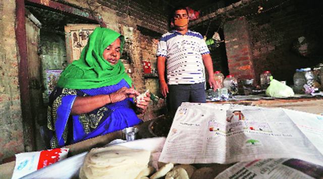 Ramrati Yadav with her son in Mohamadpur. Vishal Srivastav
SINCE HER husband’s death 20 years ago, Ramrati Yadav has been knocking on doors every day, selling samosas to sustain her family in Mohamadpur village of Uttar Pradesh’s Barabanki. Today, she says her life has finally got “kagazi mazboot” (validation on record).
The 55-year-old is one of 40,000 people across 346 villages in 37 districts of UP whose houses were mapped under the pilot phase of Swamitva, the Central Government’s new digital property card scheme. She was also chosen for a direct online interaction with Prime Minister Narendra Modi on October 11, when the scheme was launched.
“I funded the education of my two sons and daughter, and got my daughter married, all on my own. We had a small shop in front of our house, which was given out by my husband on nominal rent but after his death, the tenant refused to vacate. Now I have the strength of the official paper and the encroachment has been removed,” said Yadav, who lives with her sons in a one-room house.
Her digital card is essentially a QR code on an A-4 printout, which contains a unique ID and acts as a “Record of Rural Habitation” — or “Gharauni” in UP — and enables her to obtain a loan against her property. Yadav has already taken a loan of Rs 20,000 on her property, which is about 1,200 sq ft, and puchased a cart for Rs 8,000 to sell samosas. “I am also relieved that my sons don’t have to fight over the property,” she said.
A scan of the QR code leads to other details, such as dimensions on all four sides, a property sketch and the surrounding area — in her case, a pond in the north and a road in the south.

Local residents say the details were collected after a drone survey of the village during monsoon, which was a difficult task. “Before the survey, limestone powder was sprinkled over houses for easy demarcation but overnight rain washed that away. It had to be redone the next day. After the survey, a committee of officials, including the Sub-Divisional Magistrate, Gram Pradhan and police, sat to resolve issues and the demarcations were decided in a panchayat meeting with the agreement of all,” said Junaid Sheikh, a social worker.
Cases where agreements could not be achieved were left for settlement through other legal ways, they say.
“In some cases, parents wanted to make the division of property clear among their children. They were given that option. For instance, they had the option of putting on record “1/3” with each child getting the document for a one-third share. It has been left to them to decide how it would be divided,” said Farida Bano, 60, who has divided her property between her two sons.
In some cases, residents say, the drones “could not catch” the entire property. “We had to apply for a revision. But we finally have papers for the land we live on. I was also tempted to apply for a loan but I am not sure how we would be able to repay it,” said Imtiaz, who is a daily wage labourer with a family of nine.
Other residents say that while they are aware of the card-based loan option, they are unsure about installments, interest etc, and whether they can approach the banks directly. So far, Yadav is the only person from the village, where 250 digital cards were given, to have obtained a loan.
Apart from the pilot phase, the UP government and Survey of India have done drone mapping of 1,343 villages with about 11,000 preliminary maps of 115 villages submitted. “The survey of the remaining villages is under process. In the past one month, several glitches have been addressed. For instance, radium strips are being used for demarcation, wherever possible,” said Sanjay Goyal, Relief Commissioner, Revenue Department, which is the nodal authority for the project along with Panchayati Raj.
“There are several procedures adopted before the card is given. It is given only in cases where there are no disputes, and areas are selected for survey in about four villages per day. After that, a team of officials visit the village to make them aware about what is going to happen. After the drone survey, a ground survey is done to verify the demarcations. After that, the owners are given the initial document following which they can apply for corrections, if any,” the official said.
“Initially, there was some hesitation but now there is more awareness and a majority of people are willing to participate. The Panchayati Raj department has been given the task of undertaking the awareness campaign for the scheme,” the official said.

Sexual harassment complaint against WB Guv & Article 361Subscriber Only
In South Korea, remembering Rabindranath TagoreSubscriber Only

Laapataa Ladies: Fantasy by those who never lived in villageSubscriber Only

Modi appears to be throwing away his own lead inSubscriber Only

The clean energy transition has become messySubscriber Only
UPSC Key |EC on deepfakes, Cooperative Federalism and moreSubscriber Only
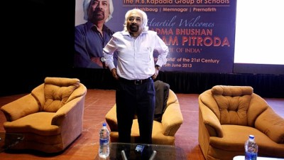
Amid row over several controversial remarks, Sam Pitroda on Wednesday stepped down as the Chairman of the Indian Overseas Congress "of his own accord." His resignation was accepted by party President Mallikarjun Kharge, Congress General Secretary in-charge (Communications) Jairam Ramesh said.