


Awaited news arrives! A fast moving fall storm, drops heavy rainfall on Southern Franklin County – but up to 7” of snow above 2000’. More good news – clearing skies by daybreak. I load my daypack with food, water, and winter hiking essentials. Early to bed, early to rise, and I am on my way toward Rangeley in early morning darkness for my first snow hike of the season. My destination is 4120’ Saddleback Mountain, via a 2.0-mile ascent (4.0 miles round-trip) on trails of the Saddleback Ski Area.
My headlights play on roadside bare ground until I reach Small’s Falls, where scatterings of snow appear. As I near Rangeley, and reach the Saddleback Mountain Road, it is evident that a snowplow has passed this way. At the base lodge parking area, I step into 4” snow.

I plan an ascent in winter hiking boots, without snowshoes, but carry a pair of flexible boot crampons in case I encounter hard-crusted snow or ice. (During the alpine ski season, boots alone are not permitted on ski trails. Snowshoes or mountain skis are required, as is an Uphill Access Pass.) The snow underfoot has a high water content, slippery even in the parking area. I opt to attach the crampons to my boots now. For added stability I have trekking poles to which I have attached snow baskets.
A great quiet abides. Snow covered slopes rest in the half-light of the pre-dawn hour. Not a single other hiker is in sight. Even after the official moment of sunrise, much time will pass before the sun will be high enough in the sky to crest the 4000’ elevation range, and brighten this north-lying ground. Chilling wind rises, falls, rises again, bearing the cold that has settled overnight by the base of the mountain, tucked into the natural bowls and hollows of lower elevation. Let’s get moving! Let’s generate some heat!
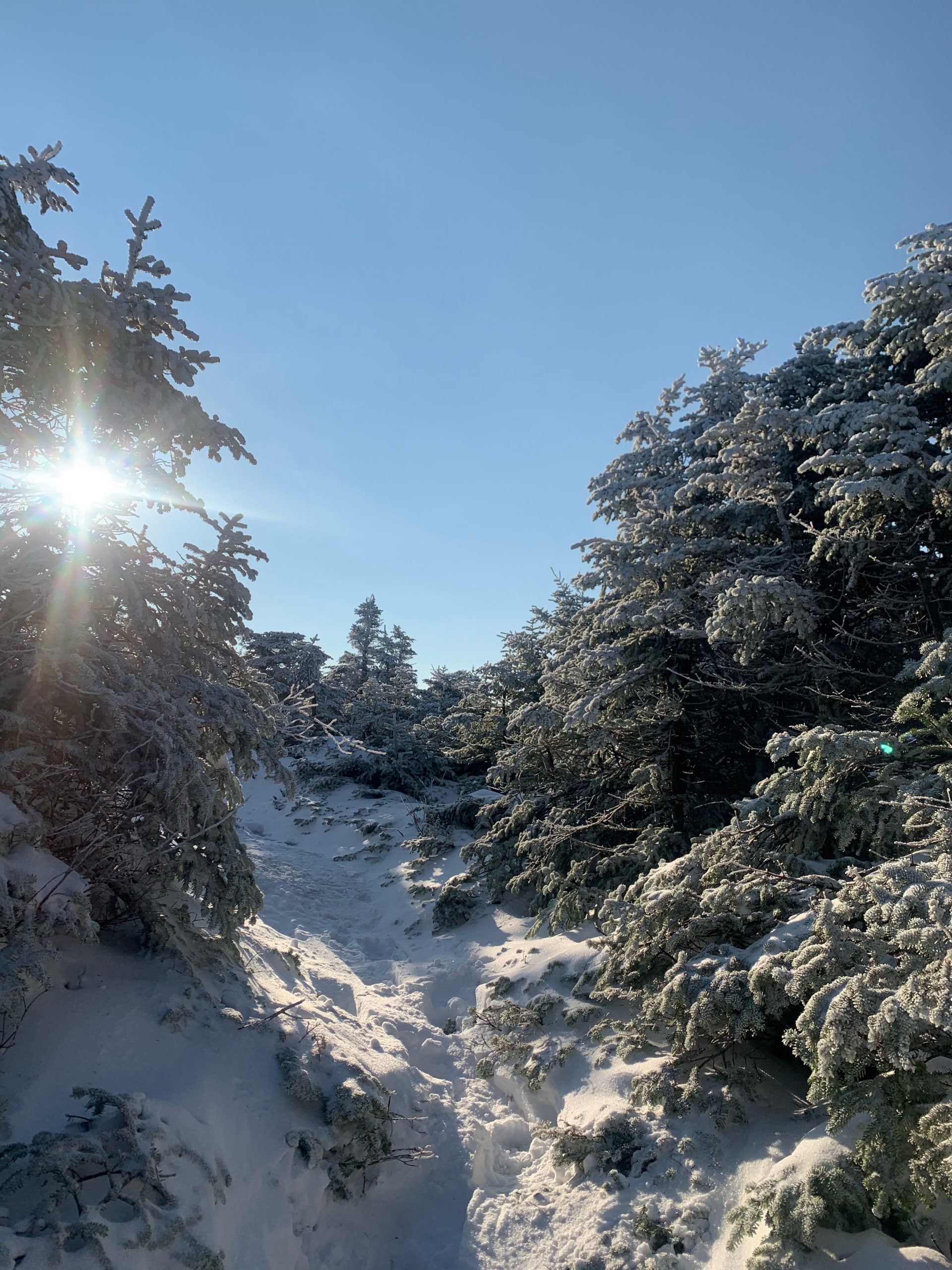
From the front step of the lodge I hike up a short section of snow-covered lawn, angle left across the Wheeler slope, and step to a maintenance track which heads more directly up the mountain. My uphill route is the Gray Ghost Trail, Lower and Upper, and the Tri-Color Trail above these. My crampons provide stable grip. I work into a rhythm, and warm up.
At the top of Wheeler slope I bear left through an opening in the trees, still on the track, reach Lower Gray Ghost, and begin a sustained climb. The trail is broad – 50’ or more across. The best footing is usually on the track, which I seek to follow, even as snow depth increases and it becomes harder to distinguish. The crampons are handy. If I were to be wearing boots alone, the going would be slippery, indeed.
Gray Ghost pauses in the ascent at a point where a lateral ski trail crosses.
I pause, too, turn around, have a look at the view behind me. The first light of the sun still has yet to touch where I stand, but to the north new morning light reaches across the broad valley that sweeps in a north and northwest direction away from the Saddleback Range. Beyond the South Branch of the Dead River, and the foothills above Rangeley, Franklin County’s northernmost high ground brightens, glowing in gold and amber hues. The West Kennebago Range, Spotted Mountain, and East Kennebago Range form this newly lighted horizon. Nearer lie snow-dusted Saddleback Lake and Gull Pond. Only a few high thin clouds remain in the otherwise sharply blue sky. Quite the sight!
I continue upward, transitioning to Upper Gray Ghost Trail, pass a Ski Patrol Hut at the top of the first chairlift, and continue on the Tri-Color Trail to a second Ski Patrol hut and a second chairlift upper station. Now above 3000’ elevation, I trek through a scene that resembles the very heart of winter. Balsam fir bear thick mantles of new snow. Reminds me of scenes from the children’s book and film The Snowman!
Sunlight slips through gaps in the irregular ridge above, brightening one tree, but not the one next to it; throwing long shadows over the unbroken snow – unbroken except for my line of tracks. Wind has blown much of the new snow off steep sections, which lie ice-covered before me. With crampons, and metal-tipped trekking poles, I ascend icy sections without incident. One break in the trees offers a glimpse of The Horn of Saddleback to the northeast (elevation 4041’), its summit aglow, sun-touched.
.
The final 0.1-mile to the exposed ridge, past the upper Ski Patrol hut and beyond the Tri-Color Trail, is a narrow and rocky route through thick firs. The way is clear enough, but in the storm of the previous day, the trail has functioned as a wind tunnel. Wind-driven snow off the ridge above has gathered in drifts 2-3 ‘ deep. I pick my way along, emerge from the low growth, and reach the ridge. I trek now in full sun!
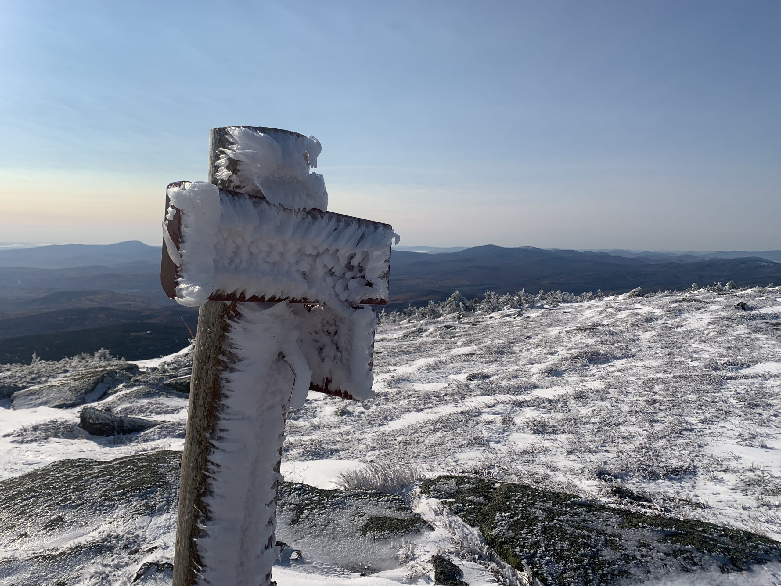
Here lies a small tarn – a small pond of glacial origin – and beyond it a new rime-frost encrusted sign at a junction with the Appalachian Trail (AT). A right turn leads down the mountain 5.5 miles to Maine Highway 4. Turning left, I head AT North for 0.2 miles to the true summit of Saddleback.
The Saddleback ridge is one of Maine’s most spectacular natural features.
Three miles of trail lie above tree line. Views runs southward toward the Maine coast, to include the Camden Hills and Cadillac Mountain on Mt. Desert Island. To the far northeast looms the familiar profile of Katahdin, faint on the distant horizon, but visible. To the north and northwest, in view from this high vantage point, above the ranges I looked upon earlier, lie the Boundary Mountains on the Maine side of the border with Quebec. That is remote territory, less frequently visited by the hiking public than peaks like Saddleback. In summer of 2020 I summited a number of them, including Snow Mountain near Chain of Ponds, and Kibby Mountain which rises between the North Branch of the Dead River and the Moose River.
On to the summit. The way varies from wind-clear open ledge, to thigh-deep drifts where high elevation scrub fir function as snow fences. Snowshoes would have helped here, but I take my time, make my way. Cairns – rock piles assembled to mark the way of the trail – designate the AT. I reach the top, elevation 4120’, still no one in sight, after two hours of hiking. That is more time than usual for me. Today is not usual – which is a good thing.
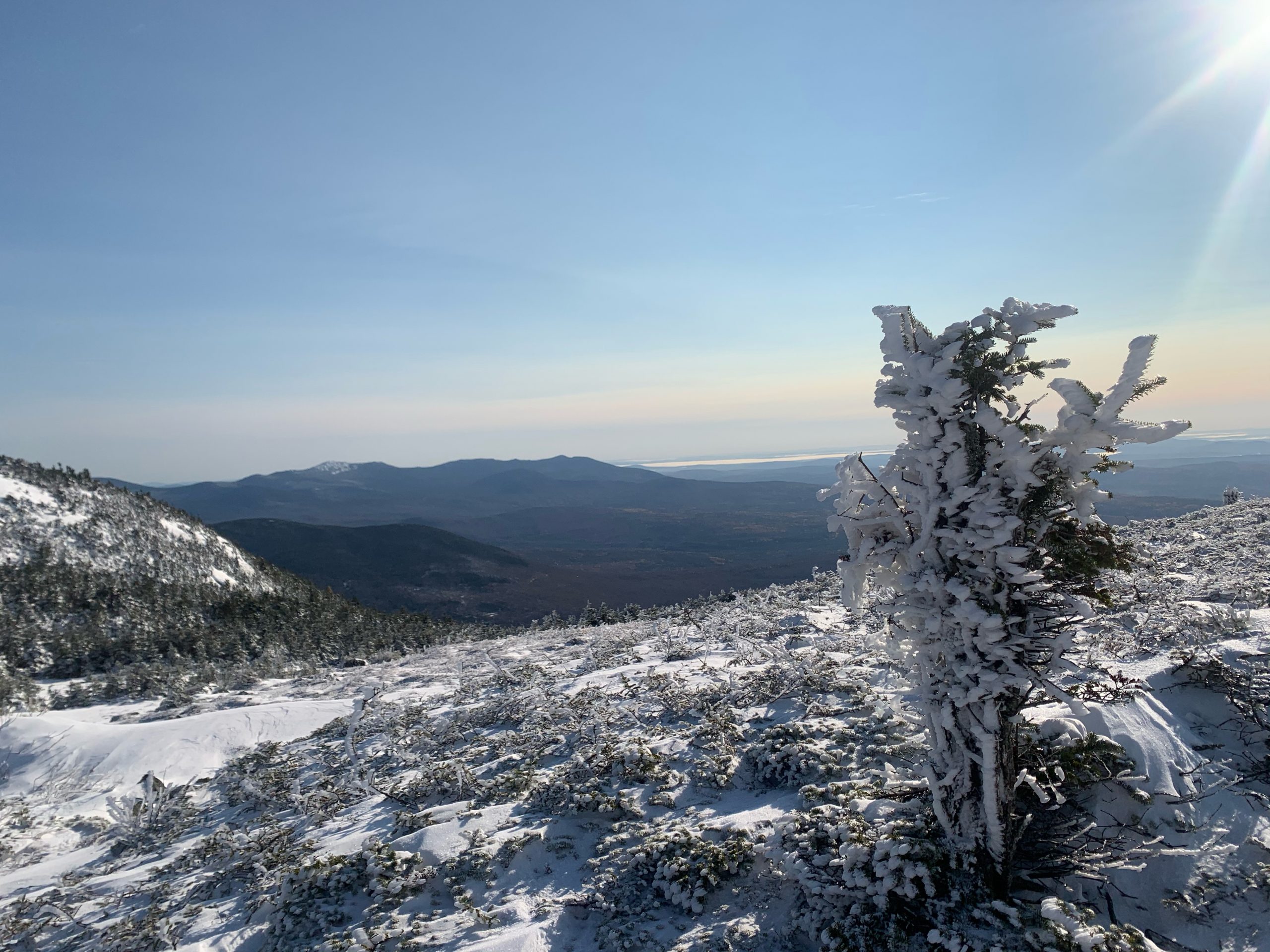
More views. I have a fine look at the long north-south ridge of Mt. Abraham. Its high elevation felsenmeer, or rock fields, lie snow covered. To the west Mt. Blue and Mt. Jackson near Weld bear striking profiles in the morning light. Well beyond, on the southwest skyline lies 6288’ Mt. Washington in New Hampshire, but cloud cover hides it for now. High elevation winds in that neighborhood surely are whipping the new snowfall on the Presidential Range snow all over the countryside. The Horn of Saddleback lies 1.6 miles north on the AT. I know that route to be particularly steep, and likely quite icy today. I hiked The Horn just one month ago, and will be back to summit it again, on another day.
The sun, now well clear of the horizon, holds to the southeast to southwest arc of late fall and early winter. The light is rich, angled, glowing. Low scrub fir, dubbed krumholtz (German for twisted trees), glacial erratic boulders, miniature cornices shaped from wind-driven snow, tufts of high elevation sedge poking through the snow – all brightened. This is a unique moment to be in the Western Mountains of Maine.
Time to turn around, head down, look forward to hot soup, which waits in my truck at the base of the mountain. I packed a hot lunch and insulated it well. That should hustle me down the mountain in good time! On the descent I meet other hiking parties, including friends with whom I have rambled about these mountains on other days. They, too, are quick to the mountain for the first snow hike of the season.

Snow Travel Tips
When Saddleback opens for the ski season, uphill access will still be available, on specified trails, during designated time frames. For safety purposes all uphill hikers (including those with snowshoes or back-country skis) require an Uphill Pass, available at the Ticket Office. To avoid damage to ski trails, and the danger of creating ruts or holes that may catch the ski edge of a descending skier, trekking by boots alone such as I did, will not be available during the ski season, Snowshoes are welcome. Contact Saddleback for details: saddleback.com
Snowshoes offer a fine way to obtain good exercise during the winter season. Rentals are available in downtown Rangeley, at the Rangeley Lakes Trails Center, and at other Franklin County locations. Ask around! Obtain a pair based upon your weight when dressed in winter clothing, and carrying your daypack. Practice putting the snowshoes on before heading out on snow. Snowshoe poles, or trekking poles with snow baskets, make a big difference – even on level ground. I do not hike in winter without them.
Carry water. Drink at least once per hour in winter. I pack a small closed cell foam pad to sit on during a break. A sturdy space blanket serves the same function. Set a turnaround time and stick to it, whether or not you have reached the top or other destination. Pack a headlamp in the event that fatigue or injury slows the hiking party, and darkness falls. Expect summit weather to be far colder and windier than at lower elevations. I carry in my pack a down jacket with a hood. When I reach high ground I don that jacket, stay warm, enjoy the view!
Text and photos copyright Douglas Allan Dunlap 2020
