
Confluence Trail in Confluence Park
Trail: Confluence Trail
Location: Confluence Park in Hurricane and La Verkin
Difficulty: Easy
Average Hiking Time: Less than two hours at a leisurely pace for the 3.6-mile round trip hike.
Family Friendly: Yes. It is an easy and almost flat hike on a crushed red rock road.
Getting There: To reach the trailhead from St. George, proceed east to Hurricane along State Route 9 (aka State Street). Stay on State Route 9 as it jogs north, crosses the Virgin River, and enters La Verkin. At 500 North Street in La Verkin, State Route 9 turns east toward Zion National Park. Do not turn, continue north on the now named State Route 17 (or State Street). About 1/2 mile past the State Route 9 turnoff, turn left (west) on 900 North Street into a subdivision named Riverwood. Stay on 900 North and in .1 mile it becomes a good dirt road. Follow the dirt road about ½ mile to Confluence Park. There is a big “Confluence Park” sign at the entrance to the large parking area with an information kiosk and pit toilets but no water. This is the trailhead and main entrance to the park.
There are three other trailheads for this hike, but all three have a steep entrance into the drainage and small parking areas.
A new year, a new hike. Works for me. My wife, Deb, and I traditionally do a hike on New Years’ Day. We have explored all over the Southwest—scores of hikes in Utah. Somehow, we missed Confluence Trail in Confluence Park stretching between Hurricane and La Verkin. This is a close-by easy less than four-mile round trip hike steeped in history. Let’s go.
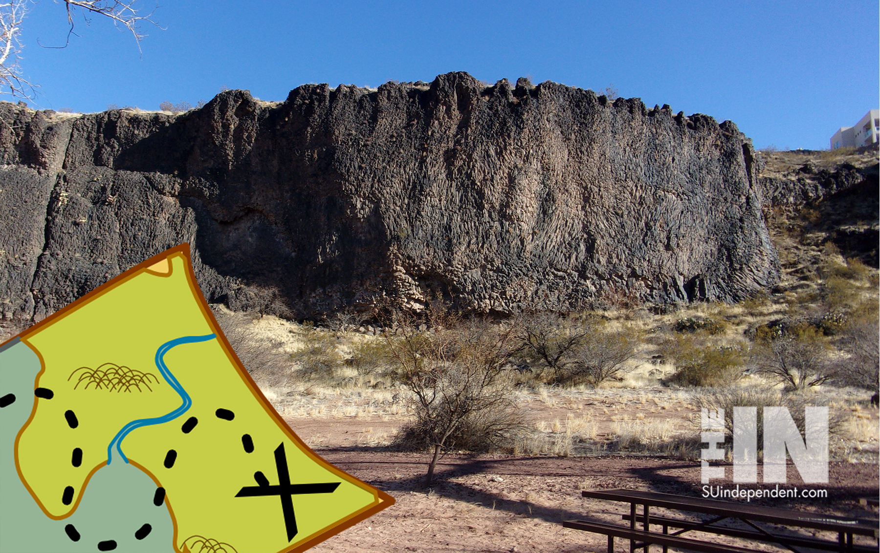
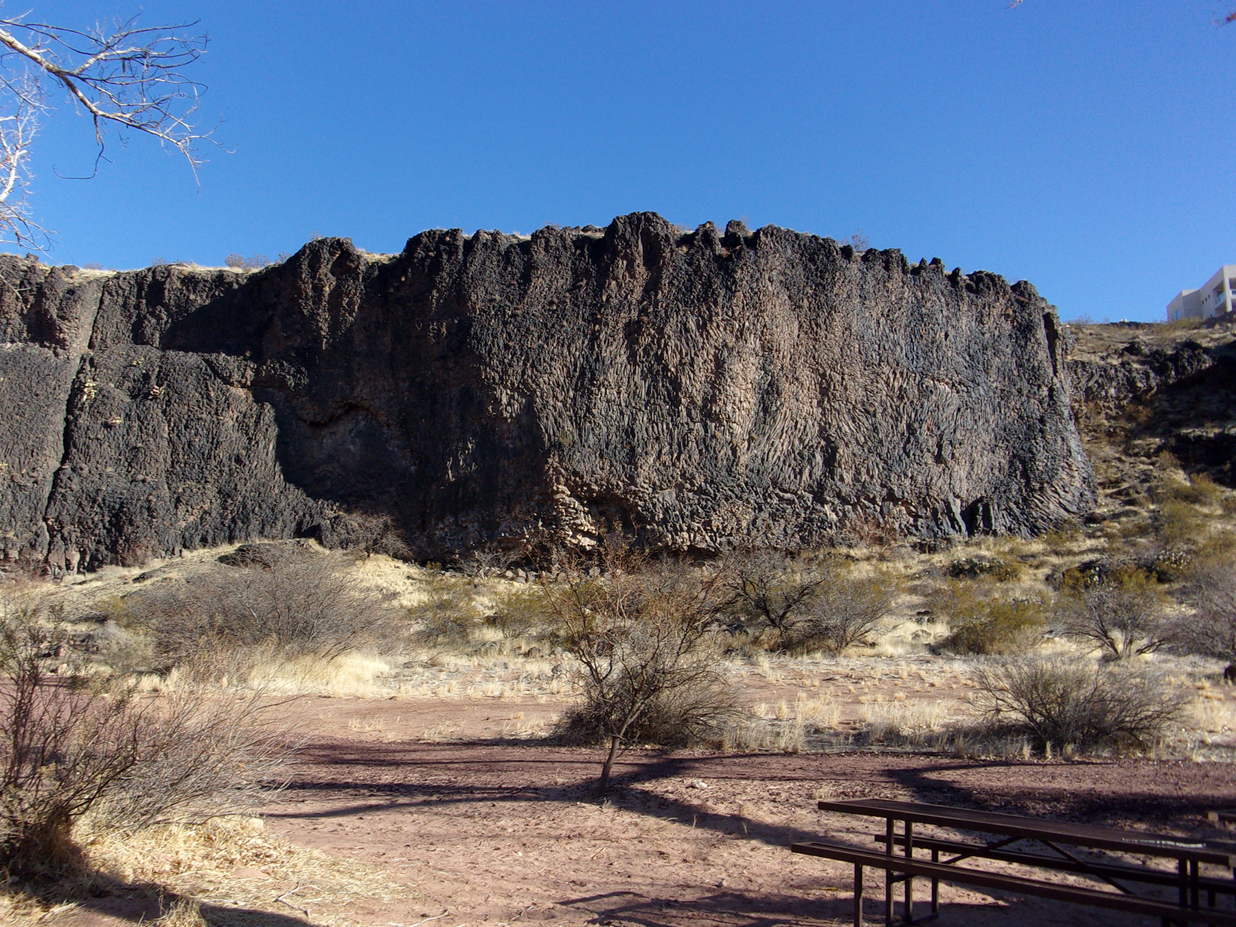
The 334-acre Confluence Park is managed by Washington County through the Red Cliffs Desert Reserve. Most of the park is at the bottom of large basalt cliffs, providing visitors some isolation from the cities (Hurricane and La Verkin) above. Oddly enough, Confluence Park is named for the confluence of Ash Creek and La Verkin Creek into the Virgin River.
The confluence area is also home to a variety of wildlife. Foxes, falcons, rattlesnakes, deer, porcupine, beaver, raccoons, and more thrive in the rich vegetation of a riparian environment uncommon to a typical desert region.
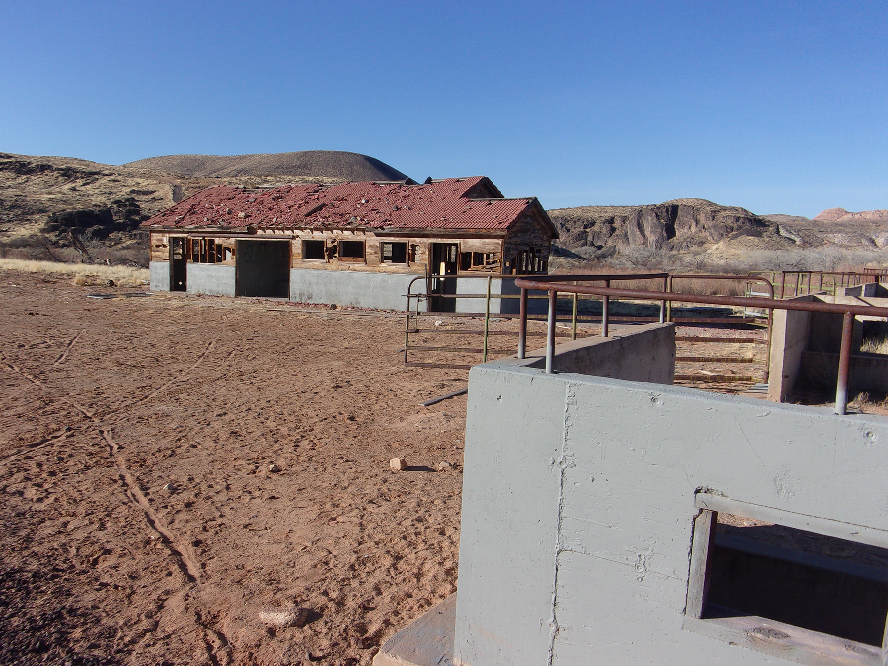
The park includes a network of ten trails. Along the longest, Confluence Trail can be found evidence of previous human habitation. The Confluence Park area has been inhabited for thousands of years. First by the Anasazi, then by Southern Paiutes, later by European explorers, and finally by fur trappers and Mormon pioneers. Among the structures and artifacts still existing are an Anasazi cave-dwelling, a nearly intact granary used for a former turkey farm, a dairy barn and corral, and an abandoned hydroelectric plant.
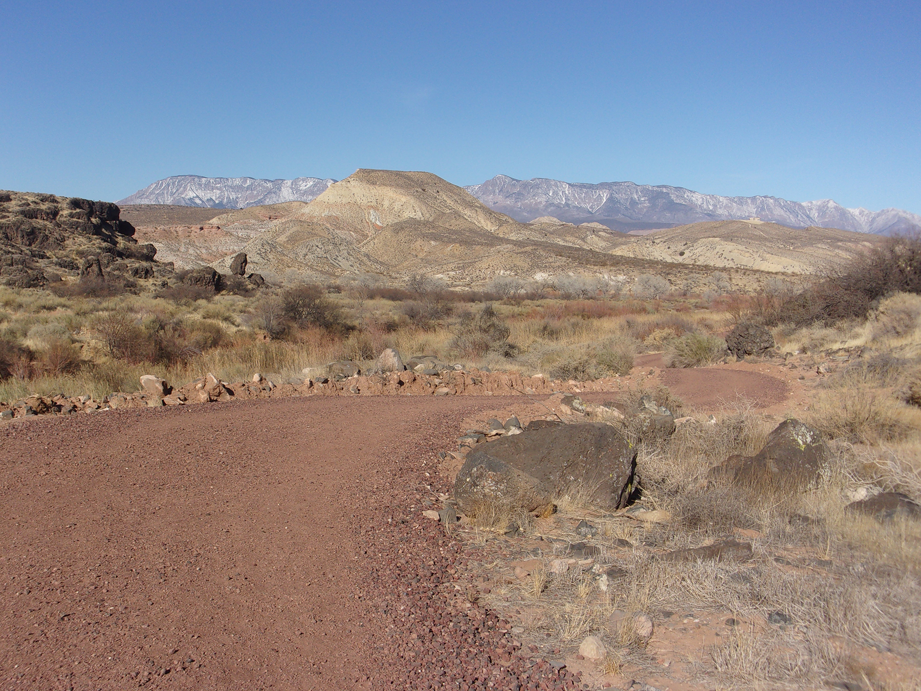
We parked and began our New Years’ Day hike along Confluence Trail about 10:00 am under blue Utah sky with the temperature in the low 40s. The trailhead elevation is 2,955 feet with less than a 100 feet elevation change during the hike.
The trailhead, also an access trail to La Verkin Creek Trail, is located at the western part of the parking area. There is a step-over and we were on the trail heading south. Saying trail conjures up the mental image of a rock-strewn dirt path. Not this trail. All the way to the endpoint, an abandoned hydroelectric plant, the “trail” is a crushed red rock road.
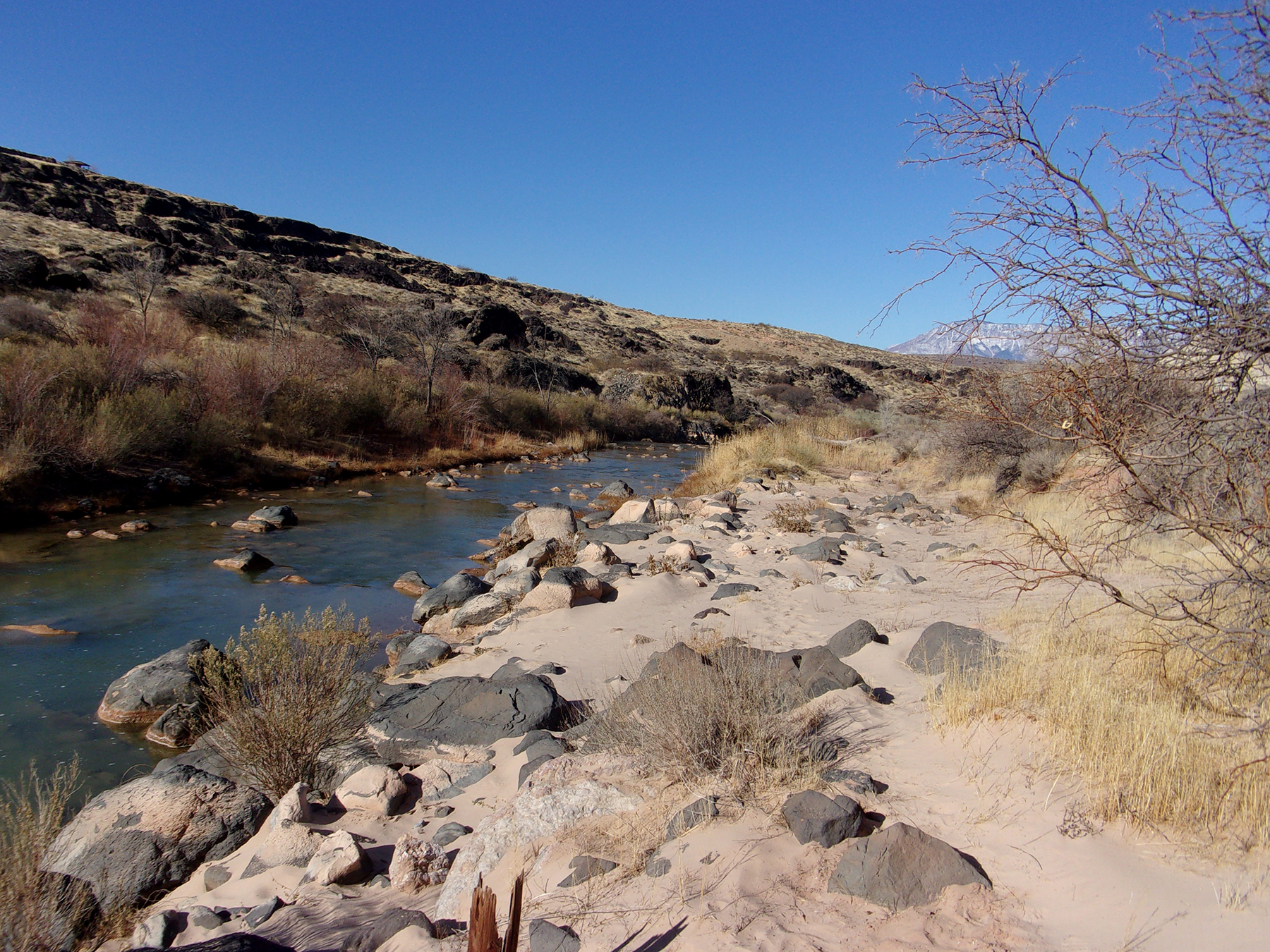
The first 1/4 mile runs along La Verkin Creek. The creek, and later on the Virgin River, are to the west (right) and massive cliffs that soon turn to basalt rock on the east (left) of the trail.
Soon the trail veered away from the creek and continued south. About ¾ mile into the hike we came across an old dairy barn and concrete corral on our right (west). At its heyday in the 1950s, the dairy had a herd of about 40 to 50 cattle.
At 1.1 miles from the trailhead, we came to a junction with Cactus Cliffs Trail. Here, at the bottom of the cliffs on our left (east), we saw the Anasazi cave dwelling. Scrambling up to it via a short user trail reveals a fire-blackened roof where, hundreds of years ago, Anasazi sought shelter and warmth from the elements.
A short walk from the junction the trail skirted the Virgin River and an open beach area with two picnic tables. A great place to stop and admire the views.
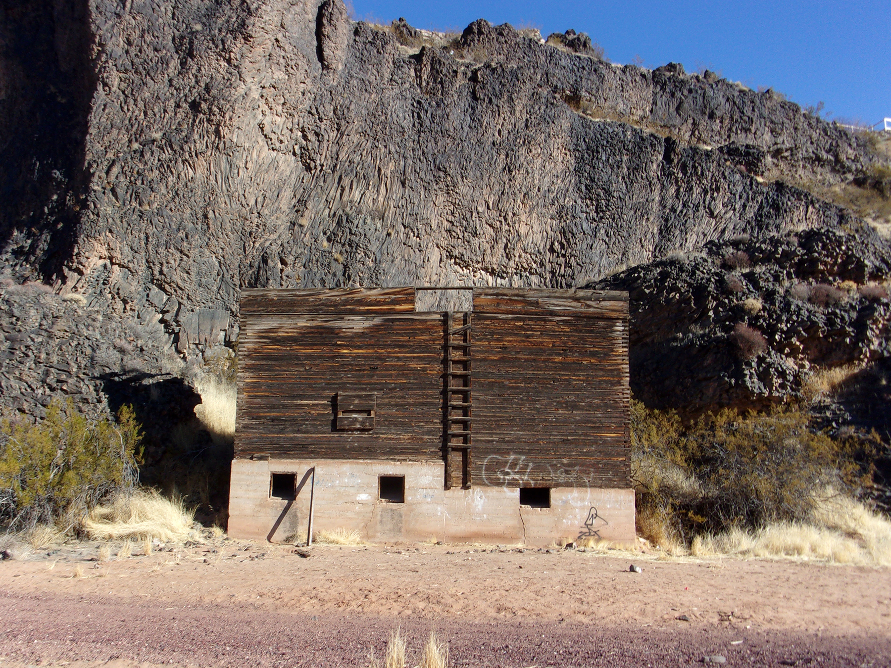
About 1.5 miles into the hike a tall abandoned grain storage building for a long-ago turkey farm appeared on our left (northeast) beneath massive basalt cliffs. Listen closely and you can hear the turkeys gobbling for some grain. We followed a user’s trail to explore the building and surrounding cliffs.
There is another red crushed rock road near the granary heading south. It roughly parallels and later joins the Confluence Trail.
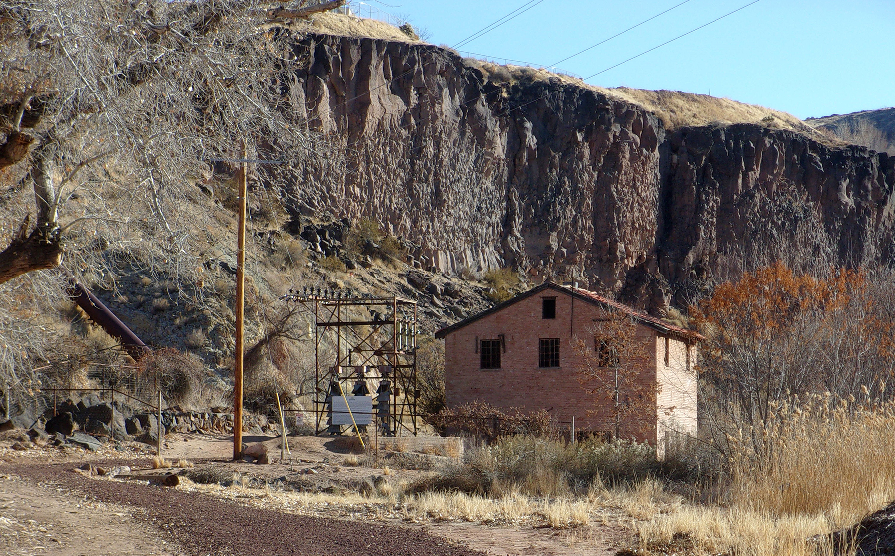
The end of the hike for us, 1.8 miles in, was the abandoned Dixie Power hydroelectric plant on the north bank of the Virgin River. Becoming operational in 1929 and closed in 1983, the ruined structure still houses the turbine and machinery once used to generate electricity. According to published reports, the generator was extremely noisy when in operation. Nice and quiet while we were there.
Being so close to civilization, I imagine this trail usually has many users. However, on a fairly cold New Years’ Day we only saw two other hikers. We did come across many birds including a covey of quail.
This 3.6-mile round trip easy hike is perfect for folks wanting to “get away from it all” for a couple of hours. It is close by with easy access and features interesting historical structures—all in a riparian environment in the middle of the desert.
Viewpoints and perspectives expressed throughout The Independent are those of the individual contributors. They do not necessarily reflect those held by the staff of The Independent or our advertising sponsors. Your comments, rebuttals, and contributions are welcome in accordance with our Terms of Service. Please be respectful and abide by our Community Rules. If you have privacy concerns you can view our Privacy Policy here. Thank you!
Click here to submit an article, guest opinion piece, or a Letter to the Editor


