- India
- International
Saturday, Apr 27, 2024
Journalism of Courage
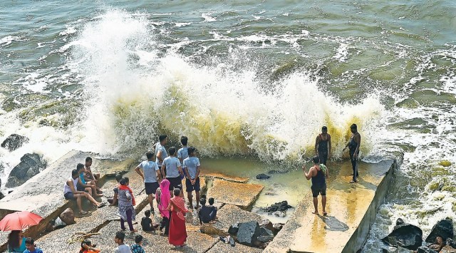 The weather department said the storm is likely to start making landfall between north Andhra Pradesh and south Odisha from late Wednesday evening. (Photo: PTI)
The regional Met department on Sunday ruled out any significant impact of cyclonic storm Gulab in Kolkata, but added that Gangetic West Bengal, including the capital city and its adjoining areas, was likely to receive heavy rains till Wednesday while strong south-easterly winds were likely to prevail. Wary after widespread floods in the region last week, the government has started alerting people in the deltaic and coastal areas.
As of Sunday morning, the storm lay over northwest and adjoining west-central Bay of Bengal, said the weather office. It is likely to start making landfall between north Andhra Pradesh and south Odisha from late Wednesday evening.
“Cyclonic Storm ‘Gulab’ lay centred at 0830 hrs IST of 26th September 2021, over northwest and adjoining west-central Bay of Bengal near Lat. 18.4°N and Long. 86.4°E, about 180 km east-southeast of Gopalpur (Odisha) and 240 km east-northeast of Kalingapatnam (Andhra Pradesh). It is likely to move nearly westwards and cross north Andhra Pradesh-south Odisha coasts between Kalingapatnam & Gopalpur, as a Cyclonic Storm with maximum sustained wind speed of 75-85 kmph gusting to 95 kmph, around midnight of today, the 26th September, 2021. The landfall process will commence from late evening of today. Strong South Easterly wind will prevail over the districts of Gangetic West Bengal on 28 & 29th Sept ’2021,” read a statement issued by Indian Meteorological Department.
Regional Meteorological Centre, Calcutta, director GK Das ruled out any significant impact here. The department forecast that there would be no direct impact of the storm in the state, but added that rains were expected on Tuesday and Wednesday. Heavy rainfall early last week had inundated several areas in the metropolis, its adjoining areas, and in other districts of south Bengal, throwing normal life out of gear.
The weather department said heavy rains and thundershowers with lightning were “very likely to occur at many places in south Bengal on Sunday and Monday, and at most places the following two days.

With another spell of rainfall being forecast, the state administration has instructed people living along the banks of the Haldia river to evacuate safely. The local police and district officials are alerting local people using loudspeakers. An alert has also been issued for tourist spots such as Digha, Mandarmani, and Bakkhali. The Lalbazar police headquarters here has instructed all police stations in the region to inspect lampposts in their areas to prevent electrocution deaths. During the last spell of heavy rainfall, at least 14 people were reported to have died of electrocution.
The weather department said gale-force winds reaching 70-80 km per hour gusting to 90 km per hour were likely to prevail over northwest and west-central Bay of Bengal on Sunday, and increase further up to 95 km per hour between Sunday afternoon and night.
“Squally wind speed reaching 40-50 kmph gusting to 60 kmph very likely along and off West Bengal coast. Squally wind speed reaching 30-40 kmph gusting to 50 kmph likely over East Midnapore district today,” said the Met office.
The department issued a yellow warning till Monday in the districts of Purba Medinipur and South 24 Parganas, and predicted heavy rain (7-11 cm) at one or two places. An orange warning for heavy rain (7-11 cm) has been issued for the districts of Kolkata, Purba and Paschim Medinipur, North and South 24 Parganas, Purba and Paschim Bardhaman, Howrah, Jhargram, Bankura and Purulia.
On Wednesday, heavy rainfall is likely to occur at one or two places in Paschim Bardhaman, Jhargram, Bankura, and Purulia.
The Met department said the sea condition would be between rough and very rough in east-central and northeast Bay of Bengal on Sunday with high waves expected in northwest and westcentral Bay of Bengal along the coasts of Odisha, West Bengal and north Andhra Pradesh till late on Sunday night or early Monday morning. It is expected to improve gradually thereafter.
“Fishermen have been advised not to venture deep into the sea till further notice,” said an official.