The first snowfall of autumn could hit some parts of the UK within days with the mercury expected to plummet causing frosty conditions, forecasters have warned.
Temperatures in some spots could be 10 degrees celsius lower than a week ago, forecasters added.
Rain has battered mosy of the UK across Monday and Tuesday and the poor weather doesn't show any sign of improving any time soon, Birmingham Live reports.
The blast of chilly weather also spells trouble for further north, with parts of Scotland braced for snowfall, after already receiving a dose of frosty weather.
The white stuff will fall just weeks after August ended, as the weather continues to turn colder and the nights draw in.
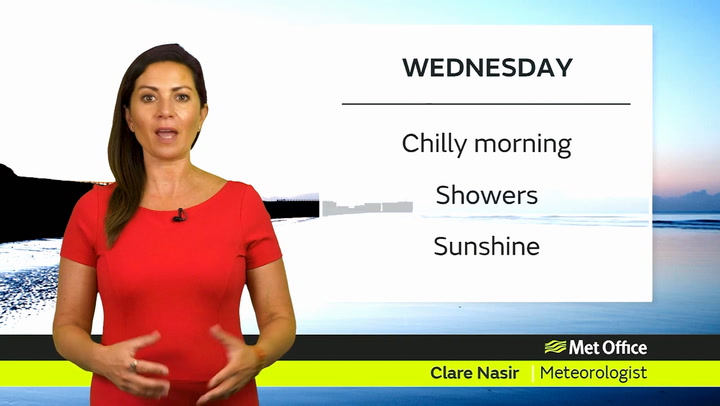
The Met Office's Aidan McGivern has warned: "With Atlantic weather now in charge, we can expect very changeable weather through the week.
"There'll be wind and rain, but also showery and sunnier periods at times."
Snow has already hit hilly parts of Scotland and more flurries are expected this week.
Meteorological expert Dave told ITV This Morning last week: "There's a snow moon on the 29th of October, followed by two more snow moons in the first three weeks of November.
“So it is gonna be bitterly cold and very frosty."
The weather expert said: “That's bad news for people with gas and electric because your bills are going through the roof.”
The Met Office forecast until October 7 currently warns: "This will bring showers or longer spells of rain, heavy at times, to many areas. Strong winds are also likely, particularly along coasts.
"As this area of low pressure moves away another is likely to move to the north of the UK. This will bring further showers or longer spells of rain to the north and northwest, along with the potential for strong winds.
And looking ahead until October 27, the meteorological agency adds: "Confidence in this period is low, however the most likely outcome is for a north-south split, with low pressure and the wettest weather remaining in the north, while pressure continues to build in the south or southwest leading to drier conditions."
Western Scotland, Wales and north-west England are expected to be the wettest areas while on Wednesday winds of up to 69mph are expected in the east of England.
The whole of the UK is forecast to experience winds averaging 35mph until the weekend.
Temperatures will be lower across the board than last week, when the south of England reached the high 20s.
And the warmest temperature expected across the UK will not top 18C throughout the week.
Some areas are set to experience up to 25mm of rain a day, most likely in eastern Scotland and eastern England, and more widely people can expect between 10-15mm of rainfall.