


By clicking “Accept All Cookies”, you agree to the storing of cookies on your device to enhance site navigation, analyze site usage, and assist in our marketing efforts Cookies Policy.
Bhubaneswar: In a big relief to the public and administration, the India Meteorological Department (IMD) on Saturday said that the cyclonic storm brewing in the Bay of Bengal will not make landfall in either Odisha or Andhra Pradesh but will move parallel to the coast. According to the weather agency’s Director General (DG) Mrutyunjay Mohapatra, the cyclone will recurve north-northeastwards and move towards the northwest Bay of Bengal after nearing the North Andhra-Odisha coast.
“The well-marked low-pressure area intensified into a depression and is now moving towards the coast in the northwestwards direction. It will continue to move in that direction till May 10 evening, and thereafter recurve in the sea north-northeastwards and move parallel to the coast,” Mohapatra said.
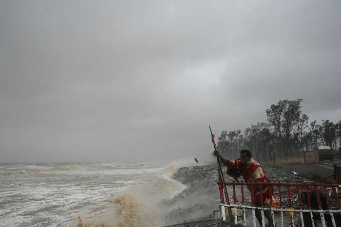
He said that sea conditions near the Odisha coast will become rough on May 9 and rougher on May 10, while the wind speed in the sea will increase to 80-90 kilometres per hour (kmph) on May 10. “In the coastal areas of Odisha, the wind speed will be around 40-50 kmph, gusting up to 60 kmph. The maximum wind speed will be 50-60 kmph. The windy conditions will prevail till May 11 and reduce thereafter,” he said.
Under its impact, Odisha’s coastal districts such as Ganjam, Gajapati, Khurda, Jagatsinghpur and Puri will receive light to moderate rainfall after May 10 evening, the senior official added.
According to IMD’s special bulletin, light to moderate rainfall is very likely to occur at many places in coastal Odisha on May 10 evening. Heavy rainfall (7-11 cm) is very likely to occur at one or two places in Gajapati, Ganjam, and Puri. The following day, heavy rain will lash one or two places in Ganjam, Khurda, Puri, Jagatsinghpur and Cuttack.
Fishermen have been advised not to venture into the deep sea on May 9, 10 and 11.
(With PTI inputs)
For breaking news and live news updates, like us on Facebook or follow us on Twitter and Instagram. Read more on Latest India News on India.com.