Denver Weather: Critical Fire Danger Followed By Heavy Snow
Get ready for a wild weather ride! Colorado is in for some whiplash as we go from critical fire danger to winter weather alerts in less than 24 hours.
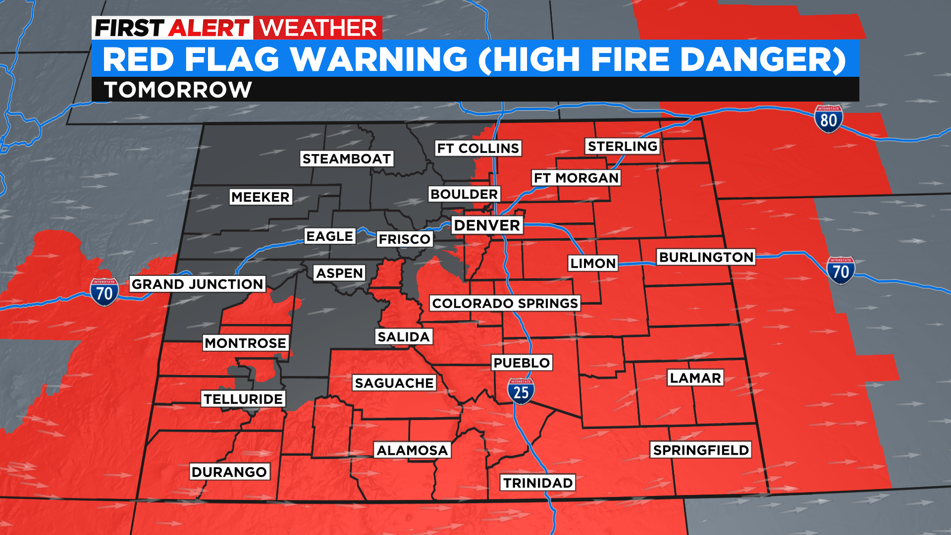
Ahead of a powerful cold front and low pressure system, we get very wind and hot! This means we are once again worried about fire danger. With how dry it has been, we are always worried about fire danger in Colorado, but with the wind and heat we expect on Thursday we are on high alert. Red Flag Warnings will cover much of Colorado.
Temperatures climb to the upper 80s. It wouldn't be out of the question that we see some 90s around the Denver area.
After that, we quickly take a drastic turn to wintery weather. Behind that cold front, we are looking at cold rain and snow to start around midnight for the northern mountains. We could see snow in Denver on Friday late morning, it most likely will start as cold rain before changing over. We have Winter Storm Watches in place for the Denver area and mountains for some pretty good snow. Denver and areas to the north may not see 10 inches of snow, areas to the south will pick up the most. Remember, this is late spring snow. So it will be wet and heavy. Also, because we've been so warm it will take awhile for any accumulation to start.
Snow and rain will continue overnight into Saturday. Try to get your planted pots under the porch or cover them up if you can. We expect temperatures below freezing both Friday and Saturday nights.