
Update at 10 a.m. — More than 2,000 Dominion customers are still without power in Arlington.
Update at 11 p.m. — The number of Dominion customers still in the dark is down modestly, to 7,378. A company spokeswoman said “the storms left a lot damage” and “crews will work thru the night as quickly & safely as possible.” More than 20,000 customers are without power throughout Northern Virginia.
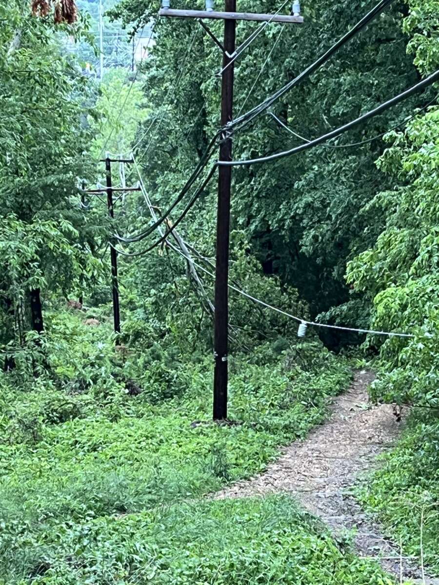
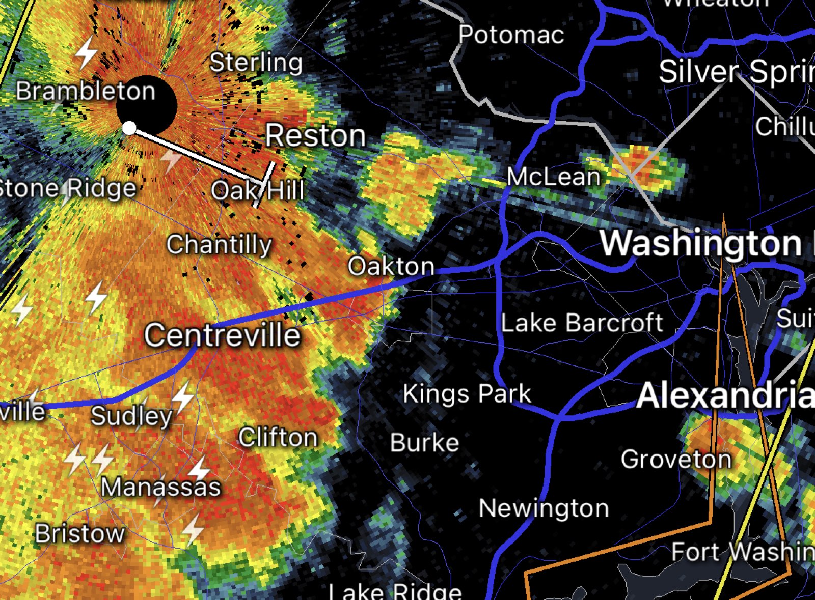
Meanwhile, a transformer explosion was recently reported in the Barcroft neighborhood, likely complicating restoration efforts.
Transformer explosion in Barcroft less than an hour ago @ARLnowDOTcom @DominionEnergy pic.twitter.com/5wV57fog22
— Jake Frederick (@JakeFrederick16) May 23, 2022
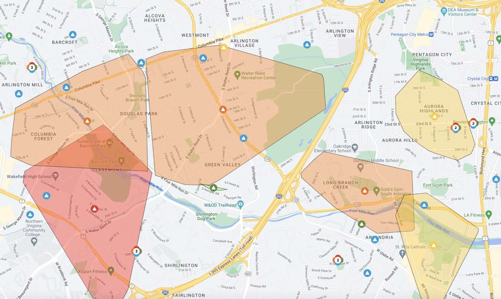
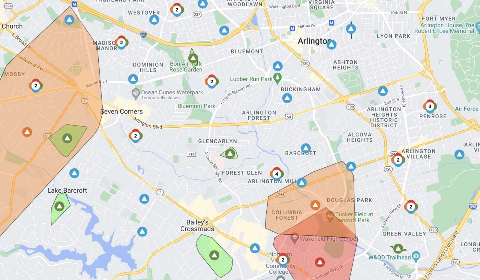
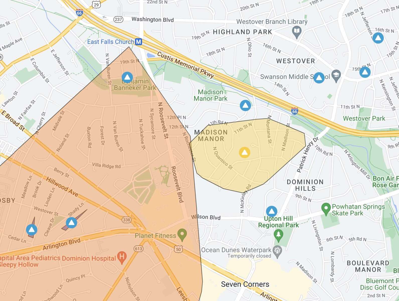
Update at 8:40 p.m. — There are 8,295 Dominion customers without power in Arlington, according to the utility company. Outages have been reported in the East Falls Church, Madison Manor, Columbia Forest, Claremont, Douglas Park, Green Valley, Long Branch Creek and Aurora Highlands neighborhoods, among others.
Fairfax Co has 9,284 outages.
Northern Va: 25,461 customer outages.We are in full storm-response with extra @DominionEnergy crews on the job.
We hope to bring service back to most by switching. But replacing downed poles wires will take longer.
Thank you for your patience. https://t.co/MSLfbWHGBw pic.twitter.com/GBt7ca4JKZ— Peggy Fox (@PeggyDomEnergy) May 23, 2022
Update at 7:25 p.m. — A Flood Warning has been issued as well.
718 PM EDT Sun May 22 2022
…FLOOD WARNING IN EFFECT UNTIL 115 AM EDT MONDAY…
* WHAT…Flooding caused by excessive rainfall is expected.
* WHERE…Portions of DC, central Maryland and northern Virginia, including the following counties: District of Columbia. In central Maryland, Montgomery and Prince Georges. In northern Virginia, Arlington, City of Alexandria, City of Fairfax, City of Falls Church, and Fairfax.
* WHEN…Until 115 AM EDT.
* IMPACTS…Flooding of rivers, creeks, streams, and other low-lying and flood-prone locations is imminent or occurring.
* ADDITIONAL DETAILS…
– At 716 PM EDT, Doppler radar indicated heavy rain due to thunderstorms. Flooding is expected to begin shortly in the warned area. Between 0.5 and 1 inch of rain has fallen.
– Additional rainfall amounts of 0.5 to 1.5 inches are possible in the warned area.
– Some locations that will experience flooding include… Arlington… Alexandria… Bethesda… Reston… Annandale… Springfield… College Park… Fairfax… Langley Park… Beltsville… Vienna… Falls Church… Huntington… Coral Hills… Bladensburg… Mantua… Pimmit Hills… Mclean… Rosslyn… American Legion Bridge…PRECAUTIONARY/PREPAREDNESS ACTIONS…
Turn around, don’t drown when encountering flooded roads. Most flood deaths occur in vehicles.
Update at 7:10 p.m. — Get ready for round two. Arlington is under another Severe Thunderstorm Warning, this time until 8 p.m.
From the National Weather Service:
BULLETIN – IMMEDIATE BROADCAST REQUESTED
Severe Thunderstorm Warning
National Weather Service Baltimore MD/Washington DC
704 PM EDT Sun May 22 2022The National Weather Service in Sterling Virginia has issued a
* Severe Thunderstorm Warning…
* Until 800 PM EDT.
* At 703 PM EDT, severe thunderstorms were located along a line extending from near Damascus to 13 miles north of Mineral, moving east at 30 mph.
HAZARD…60 mph wind gusts.
SOURCE…Measured gust to 58 mph at Dulles Airport.
IMPACT…Damaging winds will cause some trees and large branches to fall. This could injure those outdoors, as well as damage homes and vehicles. Roadways may become blocked by downed trees. Localized power outages are possible. Unsecured light objects may become projectiles.
* Locations impacted include… Arlington, Alexandria, Stafford, Columbia, Germantown, Centreville, Dale City, Rockville, Bethesda, Gaithersburg, Reston, Leesburg, Annandale, Olney, Springfield, College Park, Fredericksburg, South Riding, Fort Washington and Herndon.
PRECAUTIONARY/PREPAREDNESS ACTIONS…
For your protection move to an interior room on the lowest floor of a building.
The earlier storm packed hail, strong winds and flooding downpours in parts of Arlington.
Reagan National Airport clocked a wind gust to 59 mph not long after this. https://t.co/MqXMthvnqQ
— Capital Weather Gang (@capitalweather) May 22, 2022
The hail you speak of pic.twitter.com/S3dQIO6tv4
— Jesus H. Crust (@Lucifersmith420) May 22, 2022
Flooded roads @ARLnowDOTcom pic.twitter.com/eHCJaj4YZq
— Robert Gonzalez (@RobertG2001) May 22, 2022
VA: #Arlington I-66 Eastbound after US-29/Washington Blvd (#69) two left lanes get by at the flooding. Listen live to WTOP's latest traffic reports every 10 minutes on the 8s. https://t.co/aESgy6FEFU #vatraffic pic.twitter.com/e2EAJOnehA
— WTOP Traffic (@WTOPtraffic) May 22, 2022
It cleared out quickly, but this is the ususal I-395N pond across from the Pentagon that appears during heavy rains. Moving well now. @ARLnowDOTcom @VaDOTNOVA @capitalweather @dougkammerer @hhowardWTOP #weather #traffic #vatraffic #395cam #statcam pic.twitter.com/3gBRZjHA0y
— Dave Statter (@STATter911) May 22, 2022
It got us pic.twitter.com/vdOY8V98am
— Jim Gay (@saturnflyer) May 23, 2022
Update at 5:15 p.m. — Arlington is now under a Severe Thunderstorm Warning.
Severe Thunderstorm Warning including Washington DC, Arlington VA and Silver Spring MD until 6:00 PM EDT pic.twitter.com/H0nZp5jKW9
— NWS Baltimore-Washington (@NWS_BaltWash) May 22, 2022
Earlier: Arlington — along with D.C. and much of the region — is now under a Severe Thunderstorm Watch.
The watch is in effect until 9 p.m.
Forecasters say strong storms packing hail, damaging winds and downpours are possible late Sunday afternoon and into the evening.
More from the National Weather Service:
A Severe Thunderstorm Watch has been issued for parts of MD, VA, WV and DC until 9 PM EDT. pic.twitter.com/Z1BOAwprGH
— NWS Baltimore-Washington (@NWS_BaltWash) May 22, 2022