TALLAHASSEE, Fla. -- Authorities and residents in Florida were keeping a cautious eye on Tropical Storm Ian as it rumbled ominously through the Caribbean on Sunday, likely to become a major hurricane on its path toward the state.
Gov. Ron DeSantis has declared a state of emergency throughout Florida and urged residents to prepare for the storm to lash large swaths of the state with heavy rains, high winds and rising seas.
Forecasters are still unsure of exactly where Ian could make landfall, with current models plotting it toward Florida's west coast or panhandle regions, he said.
"The impacts will be broad throughout the state of Florida," DeSantis said during a briefing on Sunday morning. "Expect heavy rains, strong winds, flash flooding, storm surge and even isolated tornadoes," the governor added, saying that residents in the hardest-hit areas should brace for fuel disruptions, power outages and even evacuation orders. The Florida National Guard has also activated 2,500 Guard members, DeSantis said, adding that "if there's a need for more, then we can do more."
While the storm is most likely to hit Florida's west coast or Panhandle regions, the state's east coast could see flooding, DeSantis said, although he cautioned that models were still predicting a range of scenarios.
The National Hurricane Center said Ian is expected to become a hurricane today and reach major hurricane strength Tuesday. Flash and urban flooding is possible in the Florida Keys and Florida peninsula through midweek, and then heavy rainfall was possible for north Florida, the Florida panhandle and the southeast United States later this week.
The agency placed a tropical storm watch over the lower Florida Keys on Sunday evening and has advised Floridians to have hurricane plans in place and monitor updates of the storm's evolving path.
Tropical storm conditions could reach South Florida as soon as early Wednesday and northern Florida by Thursday morning. Ian is predicted to peak as a 130-mph Category 4 hurricane west of the Florida Straits on Tuesday, which would make it the strongest September hurricane to pass through the Gulf of Mexico since Rita in 2005. But the storm's track and intensity are uncertain as it approaches the U.S. mainland.
"Ian is going to be a large and powerful hurricane in the eastern Gulf of Mexico and spread its impacts over a large portion of the Florida Peninsula," Jamie Rhome, acting director of the National Hurricane Center, said in a briefing Sunday.
While satellite imagery of Ian may not currently look "overly impressive," that will change as the storm unfolds and become "a little unsettling as that satellite really builds out," Rhome warned.
"A lot of people are going to run to the stores when they see that, so I stress that you use the rest of today to finalize your preparation while it's calm," he said.
"The surge vulnerability along the west coast of Florida is very extreme," Rhome said, adding, "I'm telling you, it doesn't take an onshore or direct hit from a hurricane to pile up the water."
The storm is expected to become a hurricane sometime today and reach "major" hurricane strength by Tuesday as it approaches western Cuba, according to the National Hurricane Center. Major hurricanes are Category 3 or above storms, packing sustained winds above 111 mph.
A hurricane warning was in effect Sunday for Grand Cayman and the Cuban provinces of Isla de Juventud, Pinar del Rio and Artemisa.
Cuban state media said emergency authorities have met to plan for the storm's arrival and prepare for evacuations, though none had been ordered as of Sunday. The track forecast by the National Hurricane Center shows a major storm striking the far-western part of the island early Tuesday, close to the country's most famed tobacco fields.
At greatest risk will be Cuba's Guanahacabibes Peninsula, a roughly 60-mile-long sparsely populated strip of land at the western tip of the island nation. The Roncali Lighthouse, dating to 1849, has stood sentry at the peninsula's westernmost point and weathered dozens of hurricanes.
The NHC estimates that a 9- to 14-foot storm surge could sweep ashore, primarily near and east of the center, where onshore winds push water against the coast. The surge represents a storm-driven increase in water levels above ordinarily dry ground.
Western Cuba also faces 6 to 10 inches of rain and locally as much as 16 inches, potentially triggering flash flooding and mudslides. Heavy rainfall is also forecast over Jamaica and the Cayman Islands, where 4 to 8 inches is possible.
President Joe Biden also declared an emergency, authorizing the Department of Homeland Security and the Federal Emergency Management Agency, or FEMA, to coordinate disaster relief and provide assistance to protect lives and property. The president postponed a scheduled Sept. 27 trip to Florida because of the storm.
John Cangialosi, a senior hurricane specialist at the Miami-based center, said in an interview Sunday that it is not clear exactly where Ian will hit hardest in Florida. Residents should begin preparations, including gathering supplies for potential power outages, he said.
"It's a hard thing to say stay tuned, but that's the right message right now," Cangialosi said. "But for those in Florida, it's still time to prepare. I'm not telling you to put up your shutters yet or do anything like that, but it's still time to get your supplies."
Local media in Florida have reported a consumer rush on water, generators and other supplies in some areas where residents moved to stock up on goods ahead of the storm.
Ahead of the storm, some school districts in Florida announced closures. Hillsborough County Public Schools said it had "no choice but to close schools" Monday through Thursday because county officials planned to use many schools as storm shelters starting Monday. Pasco County Schools said schools and offices would be closed Tuesday and Wednesday.
Kevin Guthrie, director of the Florida Division of Emergency Management, said the state has begun loading trailers with more than 2 million meals and more than 1 million gallons of water to be ready to be sent into affected areas. He said the state has had frequent communication with local governments and is processing requests for resources.
Guthrie added that as of Sunday afternoon, the division had 360 trailers loaded with meals and water ready to distribute to residents.
Georgia Gov. Brian Kemp on Sunday moved to activate the State Operations Center to respond to any potential storm damage. He told residents to monitor the weather and calmly take precautions if necessary.
At the Kennedy Space Center, NASA kept close watch on Ian's projected path while debating whether to move its new moon rocket off the launch pad and into shelter. Managers already have bumped the test flight from this week to next because of the storm.
As of 8 p.m. Sunday, Ian was centered 160 miles south of Grand Cayman and about 430 miles southeast of the western tip of Cuba, while churning to the northwest at 12 mph. Its peak winds were 60 mph, a 15 mph increase since Sunday afternoon. The storm will be moving over exceptionally warm waters, which are expected to fuel its intensification.
Ian is the ninth named storm of the 2022 Atlantic hurricane season. A storm is given a name after it reaches wind speeds of at least 39 mph.
Information for this article was contributed by Anthony Izaguirre and Julie Walker of The Associated Press, Matthew Cappucci, Hamza Shaban, Jason Samenow and Dan Diamond of The Washington Post, and by staff writers of The New York Times.
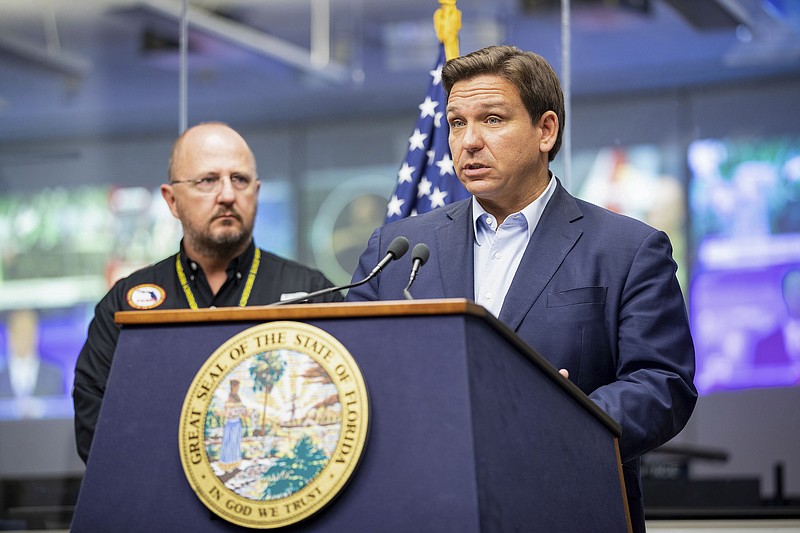
 Florida Gov. Ron DeSantis speaks during a news conference at the Emergency Operations Center in Tallahassee, Fla. Sunday, Sept. 25, 2022. Authorities and residents in Florida are keeping a cautious eye on Tropical Storm Ian as it rumbles through the Caribbean. The National Hurricane Center said Sunday it expects Ian to rapidly strengthen and become a major hurricane by Monday as it passes over Cuba. Gov. DeSantis has declared a statewide emergency, expanding an order from Friday that had covered two dozen counties. (Alicia Devine/Tallahassee Democrat via AP)
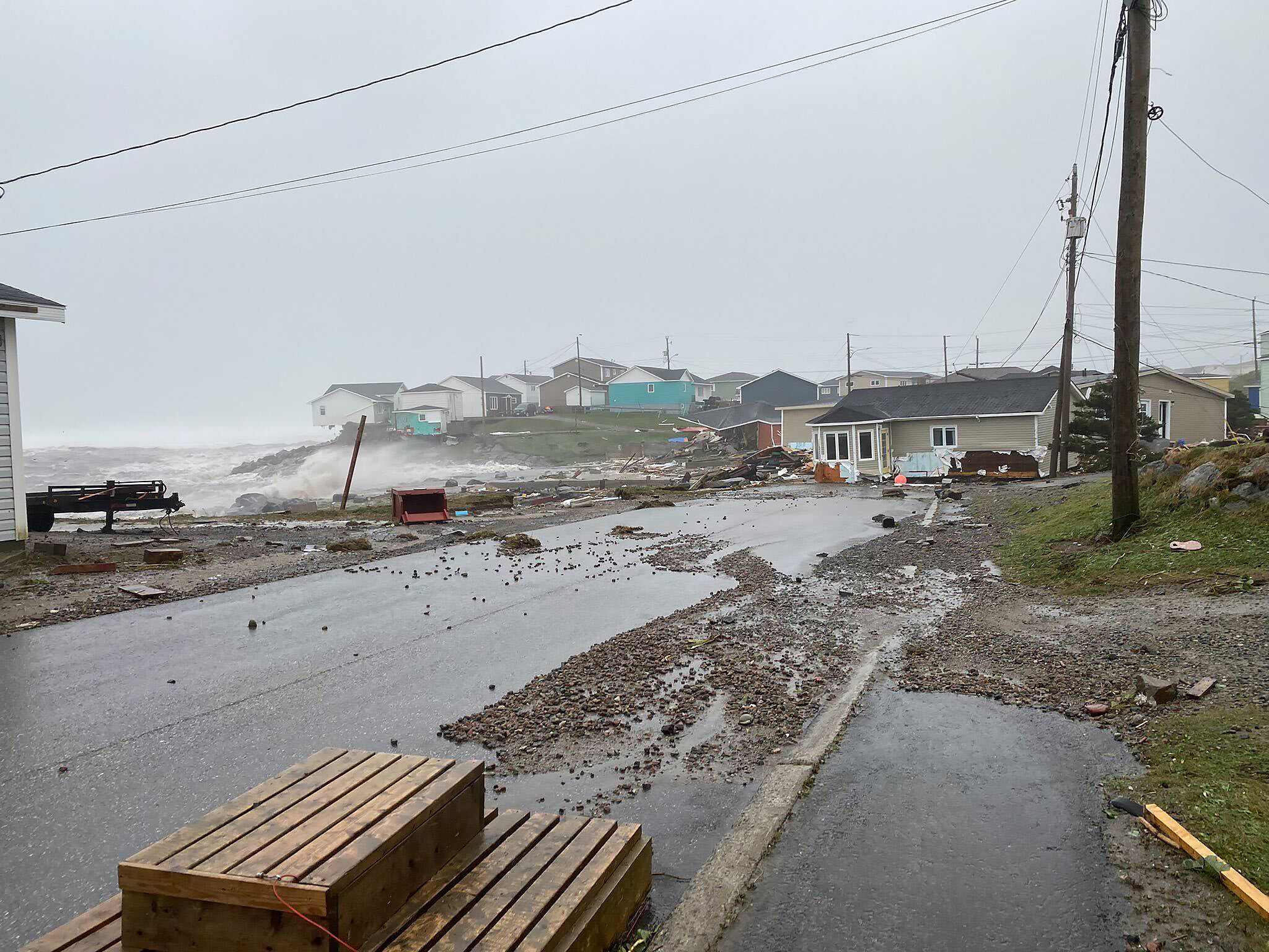 This photo provided by Wreckhouse Press shows damage in Port aux Basques, Newfoundland and Labrador, caused by post Tropical Storm Fiona on Saturday, Sept. 24, 2022. (Rosalyn Roy/Wreckhouse Press via The Canadian Press via AP)
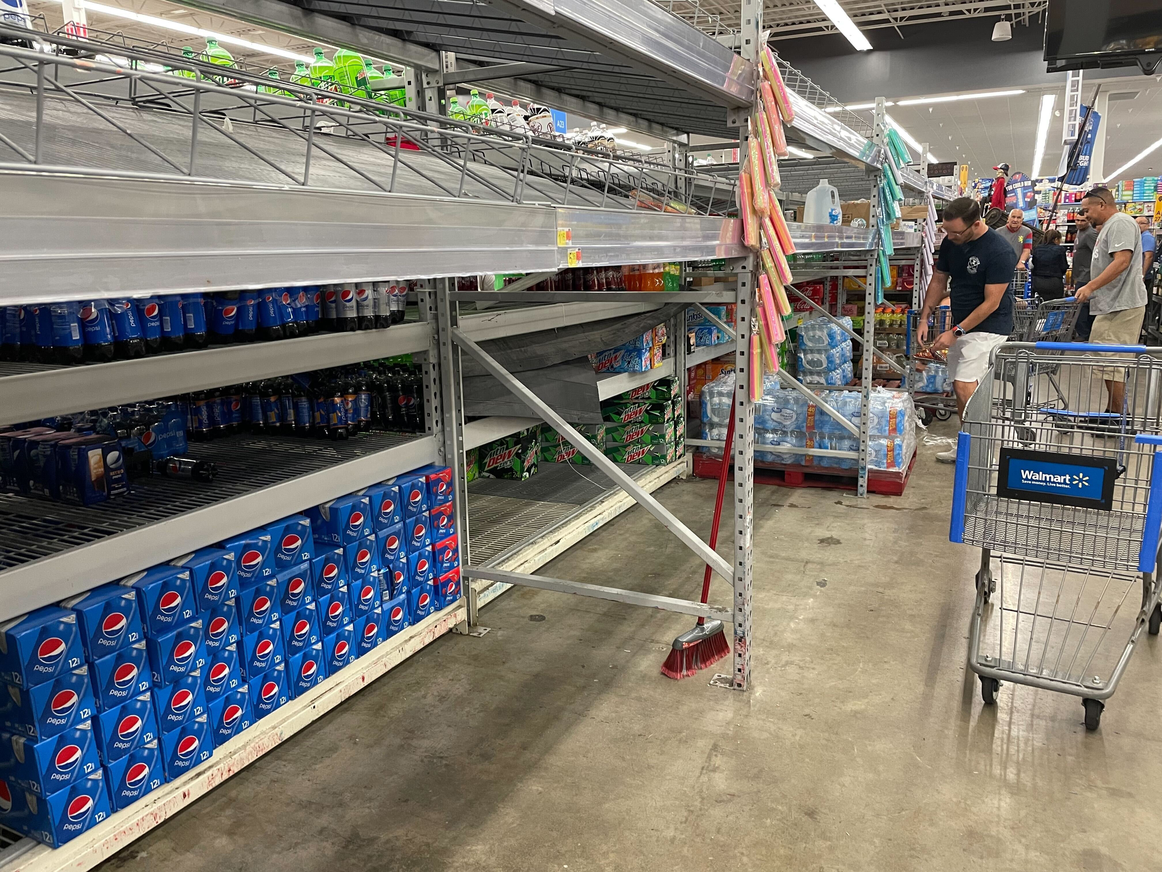 Shoppers go for what was left of the water on the shelves of the Walmart Supercenter at 1505 N. Dale Mabry Highway on Sunday, Sept. 25, 2022, in Tampa, Fla., as Tropical Storm Ian threatened to impact the Tampa Bay as a major hurricane later in the week. (Matt Cohen/Tampa Bay Times via AP)
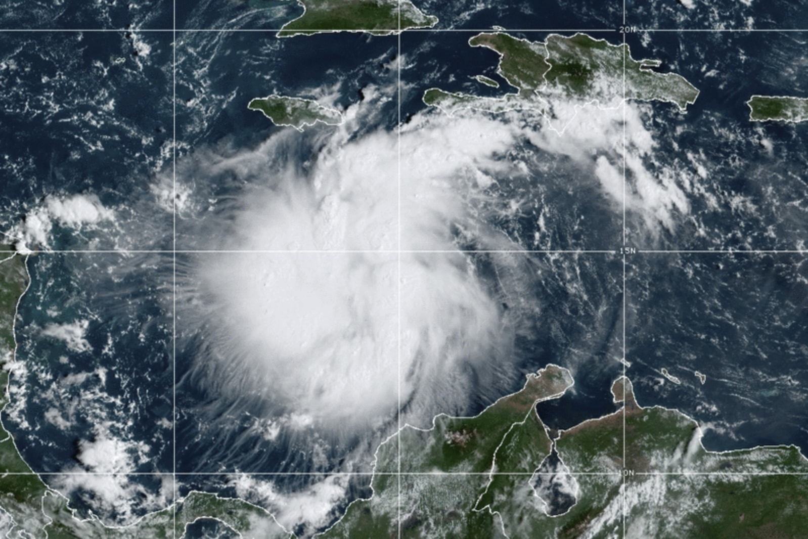 This satellite image provided by the National Oceanic and Atmospheric Administration shows Tropical Storm Ian over the central Caribbean on Saturday, Sept. 24, 2022. (NOAA via AP)
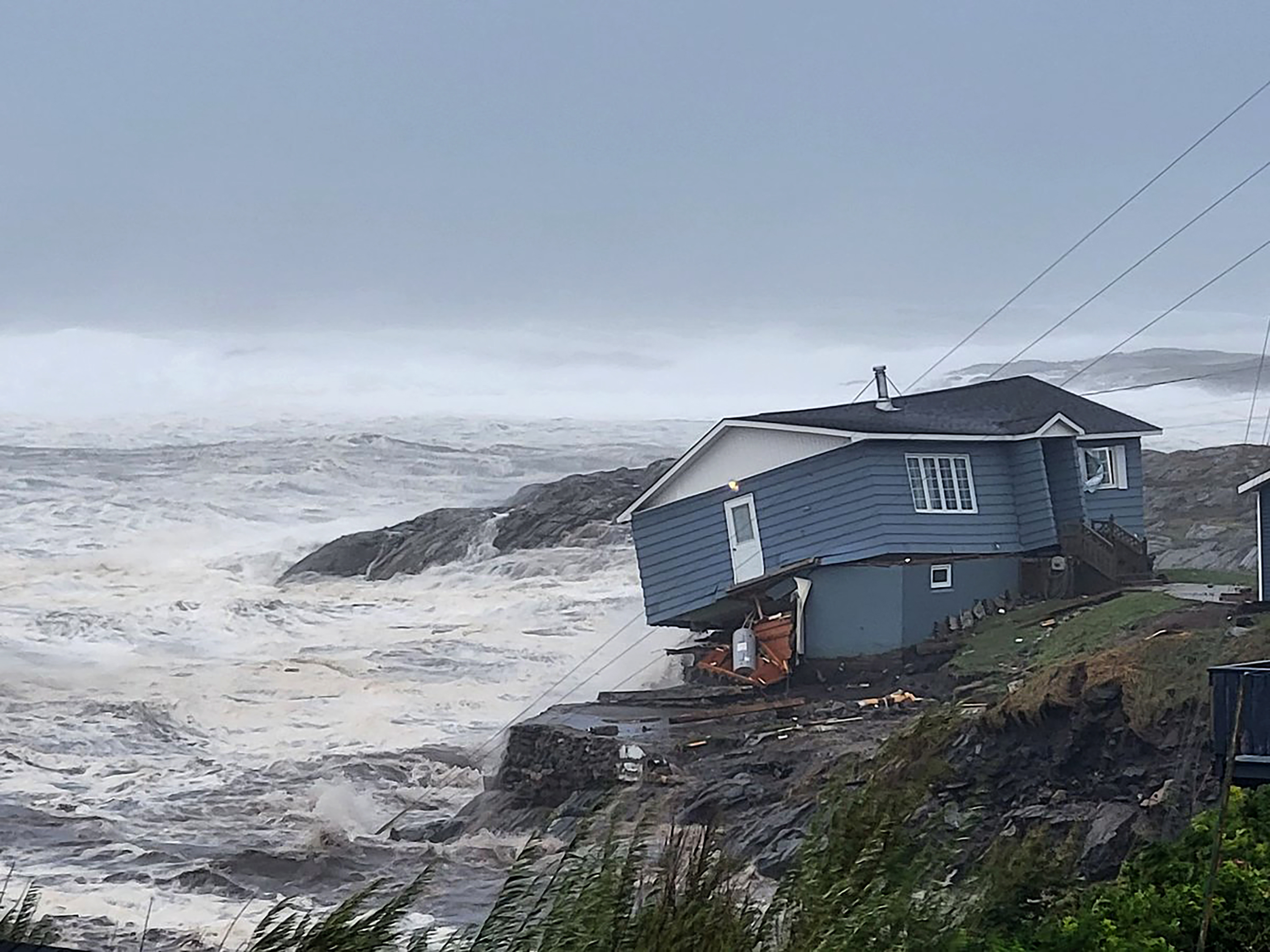 In this photo provided by Wreckhouse Press a home fights against high winds caused by post Tropical Storm Fiona in Port aux Basques, Newfoundland and Labrador, Saturday, Sept. 24, 2022. The home has since been lost at sea. (Rene Roy/Wreckhouse Press via AP)
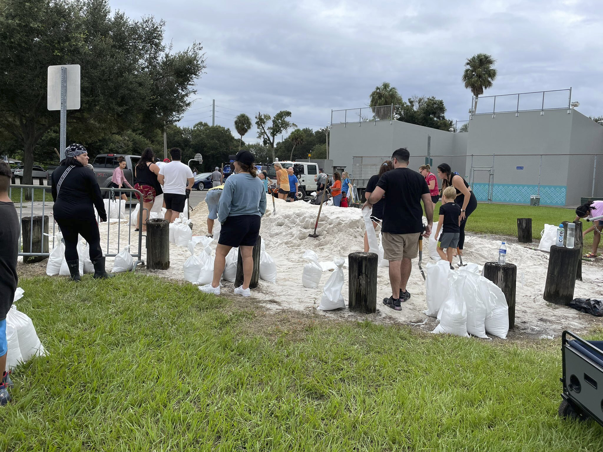 People make sandbags at MacFarlane Park, one of the city of Tampa's three sandbag sites, Sunday, Sept. 25, 2022, in Tampa, Fla. (Luis Santana/Tampa Bay Times via AP)
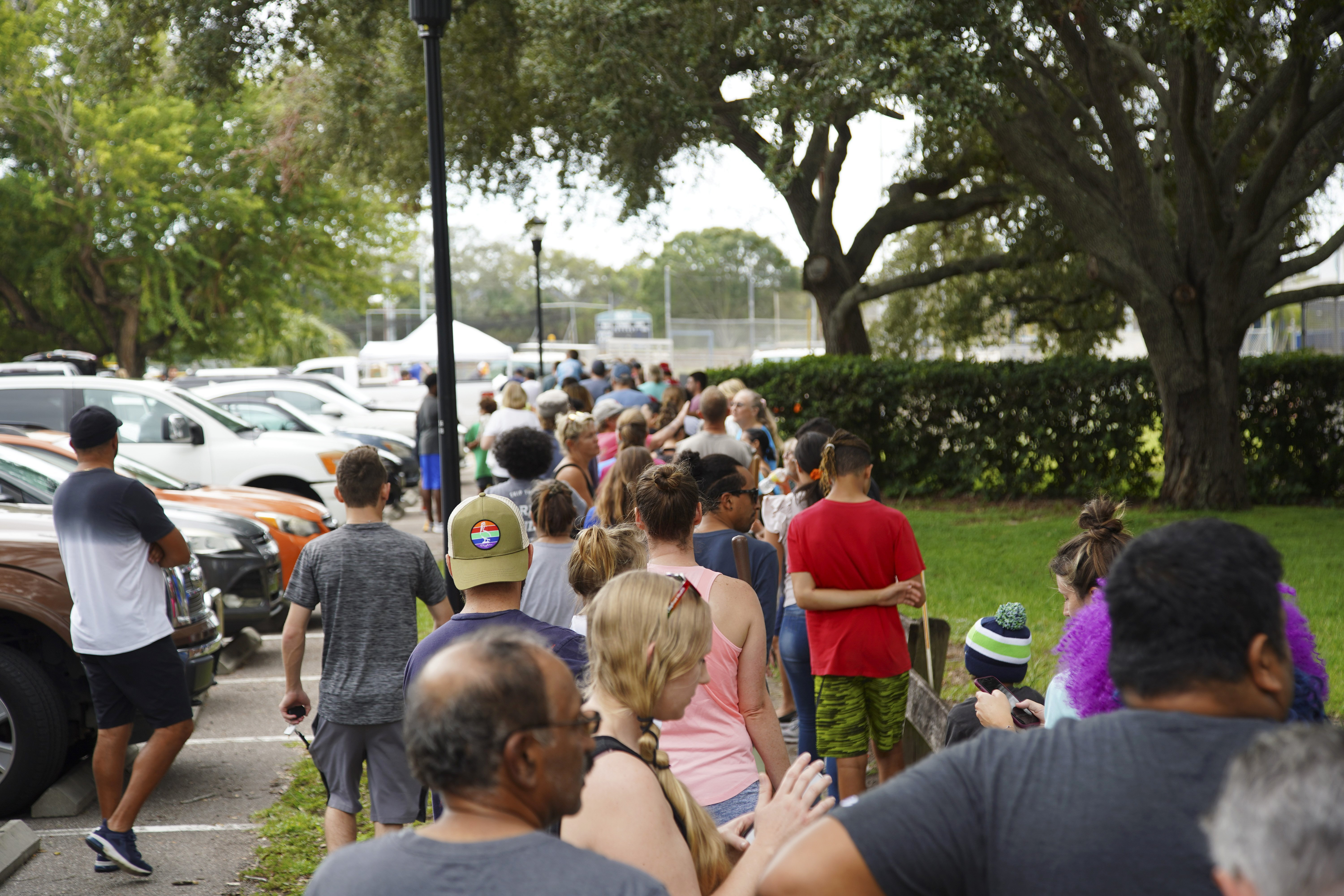 Tampa residents wait for over 2 hours at Himes Avenue Complex to fill their 10 free sandbags on Sunday, Sept. 25, 2022, in Tampa, Fla. Authorities and residents in Florida are keeping a cautious eye on Tropical Storm Ian as it rumbles through the Caribbean. (Luis Santana/Tampa Bay Times via AP)
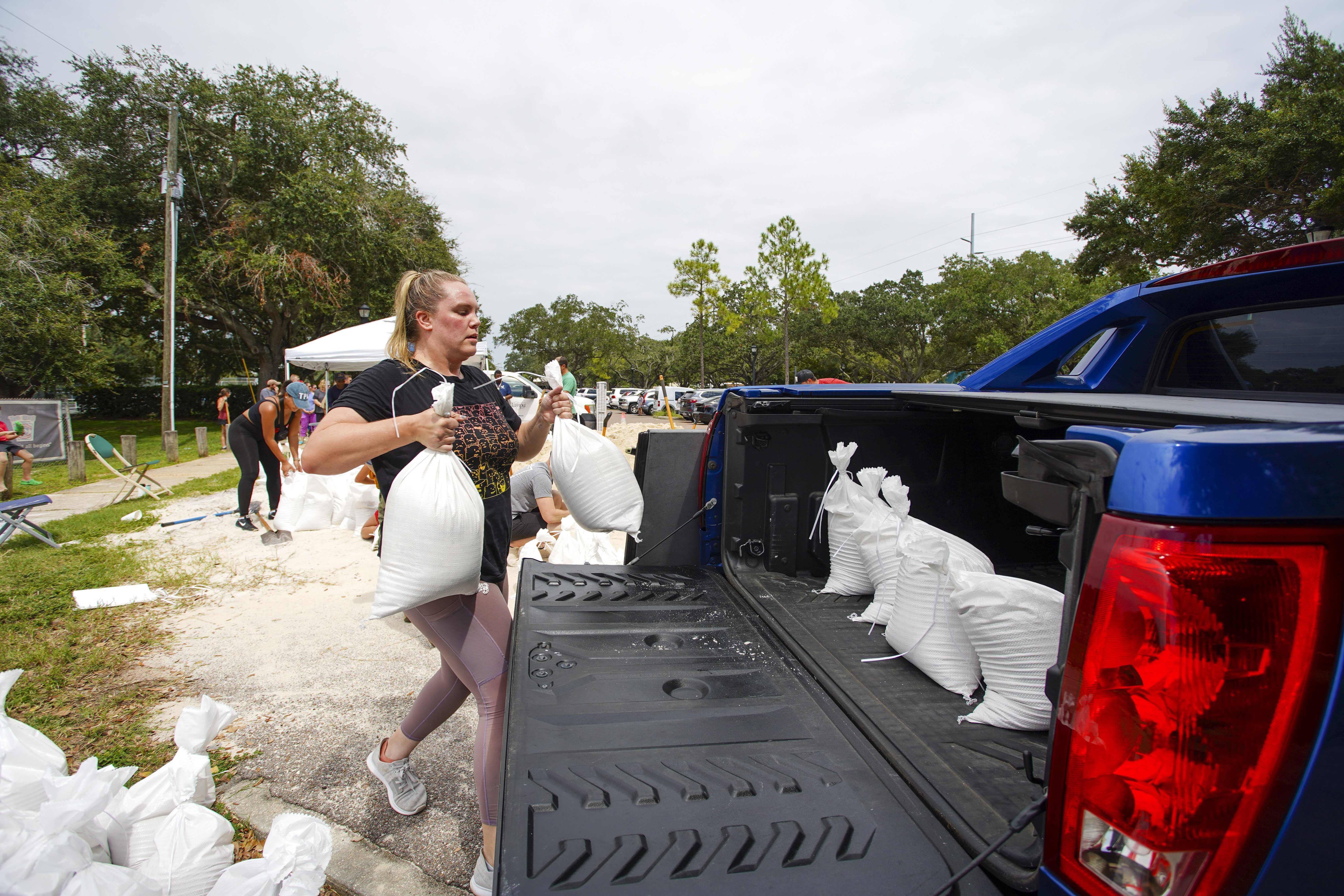 Victoria Colson, 31, of Tampa loads sandbags into her truck along with other Tampa residents who waited for over 2 hours at Himes Avenue Complex to fill their 10 free sandbags on Sunday, Sept. 25, 2022, in Tampa, Fla. (Luis Santana/Tampa Bay Times via AP)
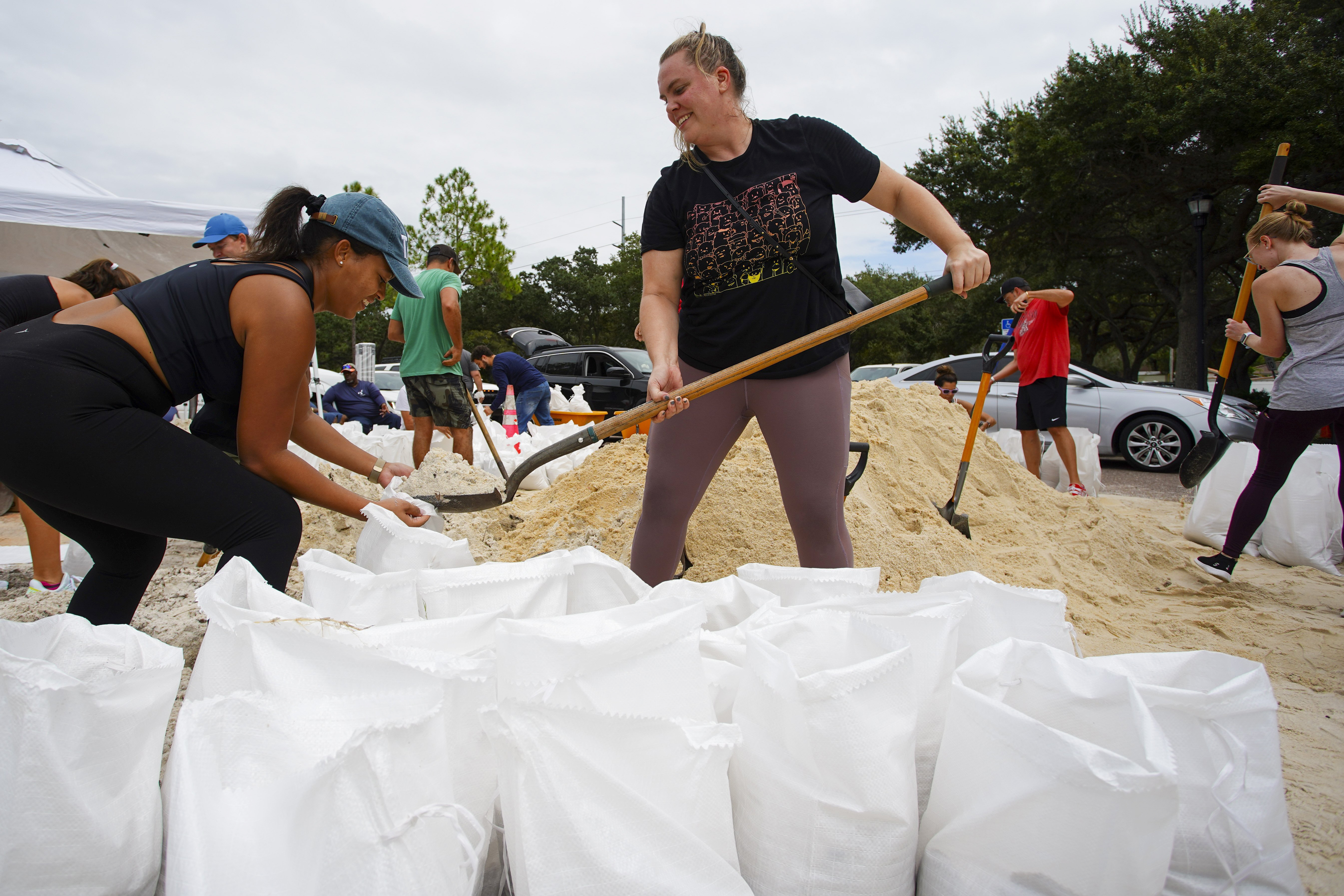 Friends Felicia Livengood, 29, and Victoria Colson, 31, fill sandbags along with hundreds of other Tampa, residents that waited for over 2 hours at Himes Avenue Complex to fill their 10 free sandbags on Sunday, Sept. 25, 2022, in Tampa, Fla. (Luis Santana/Tampa Bay Times via AP)